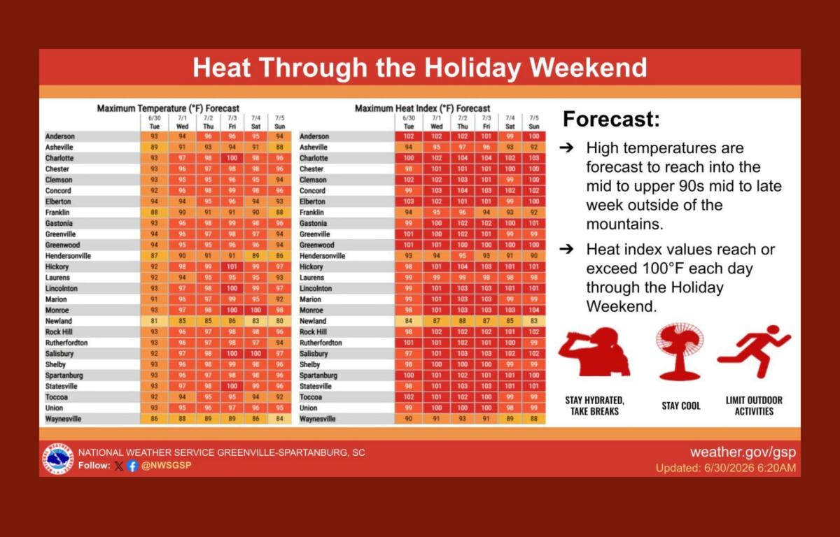

ASHEVILLE, N.C. (828newsNOW) — A prolonged stretch of hot and humid weather is expected across Western North Carolina through the Independence Day holiday weekend, with forecasters warning that heat index values could climb above 100 degrees in many areas outside the mountains.
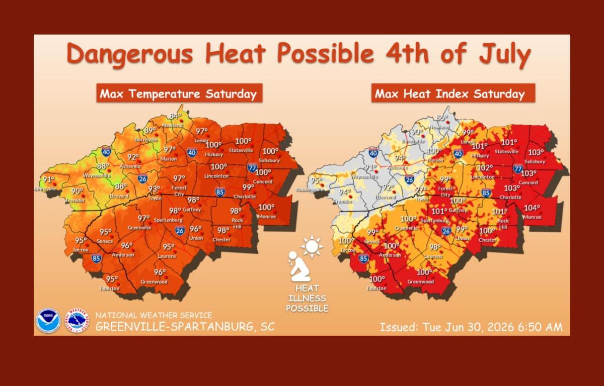
The National Weather Service in Greenville-Spartanburg said heat will build steadily through the week as a strong high-pressure system settles over the Southeast. The hottest conditions are expected Thursday through Saturday, when afternoon temperatures across the foothills and Piedmont will reach the upper 90s, with some locations nearing 100 degrees.
While Asheville is expected to be slightly cooler because of its higher elevation, temperatures are still forecast to climb into the lower to mid-90s by the end of the week.
Forecasters said the combination of heat and humidity could push the heat index to between 100 and 105 degrees outside the mountains, creating an elevated risk for heat-related illnesses, especially for people spending long periods outdoors during holiday celebrations.
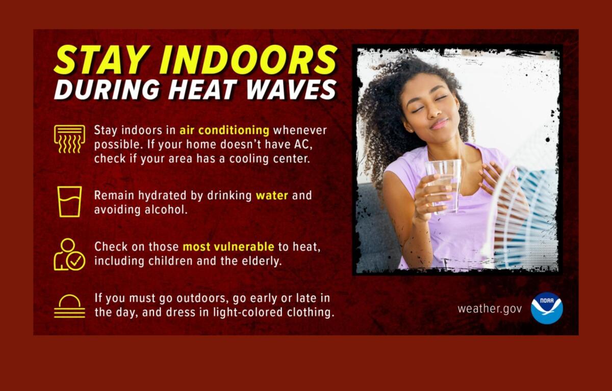
The weather service is urging residents and visitors to drink plenty of water, take frequent breaks in air-conditioned or shaded areas and avoid strenuous activity during the hottest part of the day. Officials also remind people never to leave children or pets unattended in vehicles, where temperatures can become deadly within minutes.
Heat-related illnesses can develop when the body is unable to cool itself effectively or loses too much fluid through sweating and dehydration. Symptoms can range from heat cramps and exhaustion to life-threatening heat stroke.
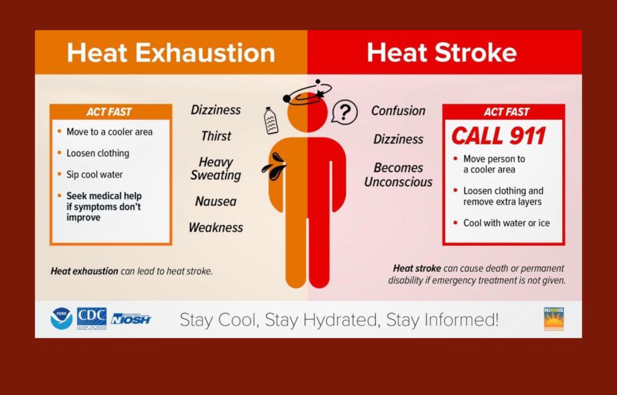
Although forecasters say widespread heat advisories are not yet certain, they note that several consecutive days of high temperatures can increase the health risks, particularly for older adults, young children, people with chronic medical conditions and those who work or exercise outdoors.
In addition to the heat, isolated afternoon showers and thunderstorms are expected each day, primarily across the mountains. Those storms could produce brief heavy rain and lightning but are expected to remain limited in coverage through much of the week.
The weather pattern is expected to become more active late in the holiday weekend and early next week as the upper-level ridge weakens, bringing a better chance of more widespread showers and thunderstorms.
Asheville forecast
- Tuesday brings a 30 percent chance of afternoon showers and thunderstorms after patchy morning fog, with a high near 90 degrees.
- Wednesday will be mostly sunny with a slight chance of an afternoon thunderstorm and a high around 92.
- Thursday is expected to be sunny and hot with a high near 94 before scattered afternoon storms develop.
- Friday will be the hottest day of the week, with a high near 95 degrees and only a slight chance of a late-day thunderstorm.
- On Independence Day, temperatures are expected to reach about 93 degrees with a 50 percent chance of afternoon and evening showers and thunderstorms.
- Rain chances increase Sunday, when showers and thunderstorms become likely and highs return to around 90 degrees.