



ASHEVILLE, N.C. (828newsNOW) — Enjoy the warm weather while it lasts. Veterans Day is shaping up to be a beautiful fall day across Western North Carolina, but a blast of cold air is on the way, bringing gusty winds, freezing temperatures and the possibility of the season’s first measurable snow in the mountains.
The National Weather Service says Wednesday will be mostly sunny, with temperatures running 5 to 10 degrees above normal. Asheville is expected to reach a high near 71 degrees, making it a good day to get outside before winter-like weather arrives.
That warmth won’t last.
A strong cold front moving through the region Thursday will send temperatures tumbling, with the coldest air of the season expected to spread across Western North Carolina by the weekend.
In Asheville, Thursday’s high is expected to reach only 56 degrees, with northwest winds gusting as high as 29 mph. There’s also a slight chance of rain.
Friday will be even colder, with a high near 45 degrees and a slight chance of rain or snow showers. Forecasters aren’t expecting significant snow accumulation in Asheville, although a few snow showers are possible Thursday night and Friday.
Where snow could fall
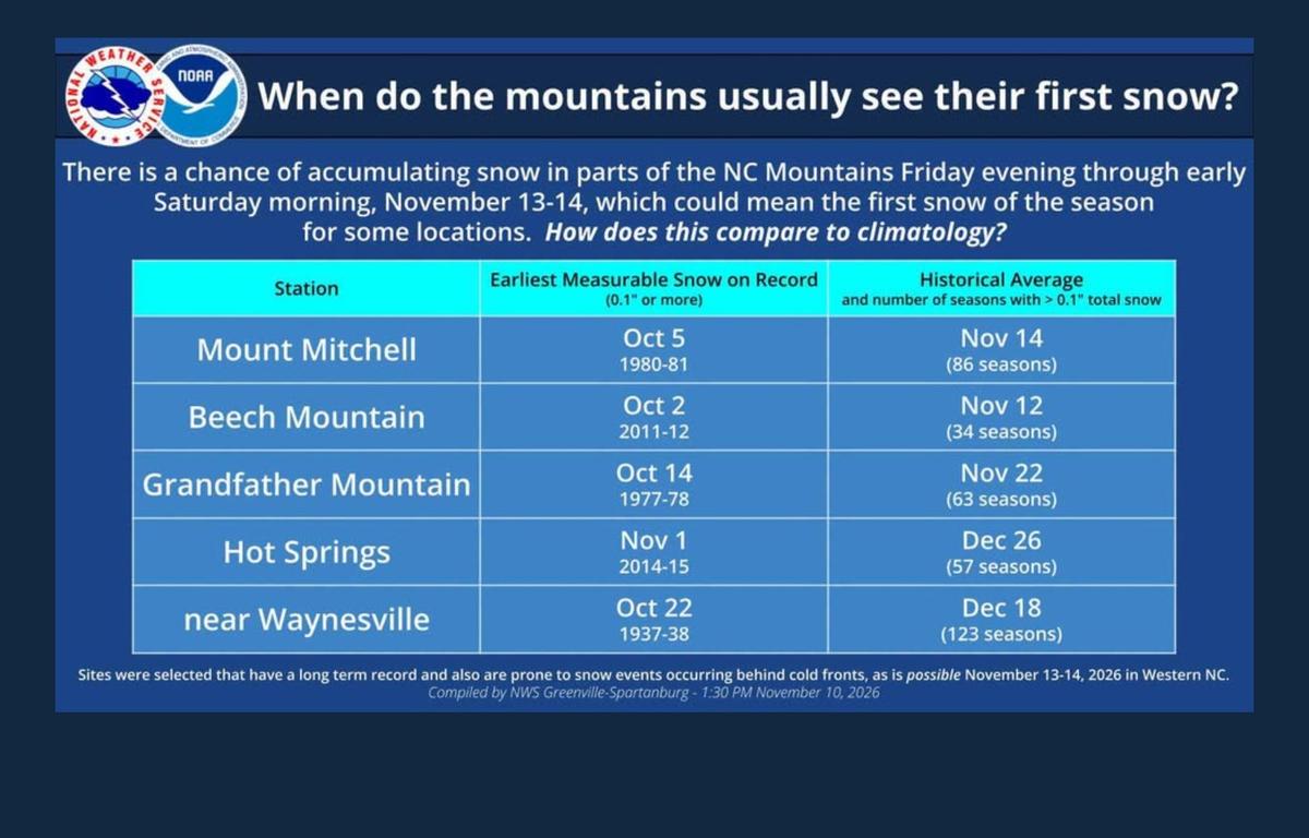
The best chance for accumulating snow will be in the higher elevations along the North Carolina-Tennessee border, particularly in the northern mountains and parts of the Great Smoky Mountains.
Forecasters say most areas along the state line that receive snow will likely see an inch or less. However, some favored locations, including northern Swain County, could pick up isolated amounts of about 4 inches.
How much snow falls will depend on how long moisture hangs around after the cold front moves through. If the moisture dries up sooner than expected, snowfall totals could be lower. If it lingers, some areas could see more.
Snow could begin in the higher elevations Thursday night and continue at times into early Saturday.
The Weather Service says a winter weather advisory does not appear necessary at this point, although that could change if expected snowfall amounts or coverage increase.
Gusty winds and freezing temperatures
The cold front will also bring gusty northwest winds Thursday through Saturday, especially across the mountains. Higher peaks and ridgelines could see gusts of 40 to 50 mph, although most areas are expected to stay below wind advisory levels.
Temperatures will take an even bigger tumble.
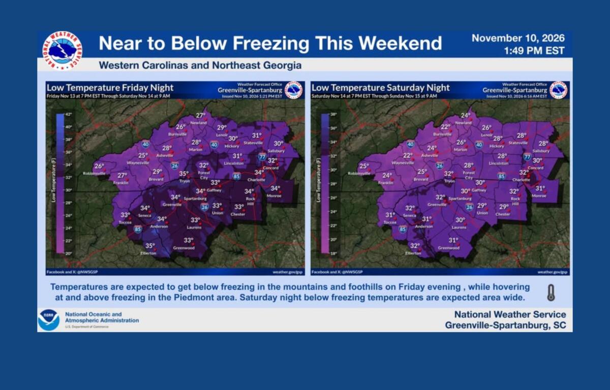
Asheville’s overnight low is expected to fall to around 32 degrees Thursday night, then drop to 26 degrees Friday night.
Saturday will be sunny but cold, with a high near 45 degrees. By early Sunday morning, Asheville could see a low around 23 degrees — nearly 50 degrees colder than Wednesday afternoon’s expected high.
The Weather Service says freezing temperatures will become widespread across the region over the weekend, with the coldest conditions expected Saturday night into Sunday morning.
Gardeners may want to take advantage of Wednesday’s warm weather to protect any plants they hope to keep through the winter.
The Weather Service is ending its seasonal frost and freeze warnings after Nov. 11, marking the close of the agricultural growing season. That doesn’t mean freezing weather is over. It means forecasters will no longer issue those particular alerts until the next growing season.
A chilly weekend ahead
The sun should return this weekend, but it won’t do much to warm things up.
After Saturday’s high near 45, Asheville is expected to warm to around 54 degrees Sunday. Another cold night will follow, with temperatures dropping to around 25 degrees.
Forecasters say daytime temperatures are expected to remain below normal into early next week.