
ASHEVILLE, N.C. (828newsNOW) — Recovery from Tropical Storm Helene continues to reshape large portions of Western North Carolina’s national forests, with federal officials warning that damage across Pisgah National Forest remains extensive months after the storm swept through the region.
An update from the U.S. Forest Service is scheduled to be presented Tuesday to the Buncombe County Board of Commissioners, outlining the scale of the destruction and the progress made so far.
According to the Forest Service, Helene left behind tens of thousands of acres of downed trees, unprecedented fuel loads and widespread damage to watersheds throughout the forest system. Officials said nearly all recreation sites suffered damage, some of it catastrophic.
The storm also heavily impacted infrastructure, damaging about 850 miles of trails and severely affecting 885 miles of forest roads. Roughly 30 percent of those roads were destroyed, the agency said.
Recovery efforts are focused on three ranger districts within the Pisgah National Forest: the Pisgah Ranger District based in Brevard, the Grandfather Ranger District in Nebo and the Appalachian Ranger District in Mars Hill, which includes areas such as Big Ivy, Shope Creek and Ox Creek.
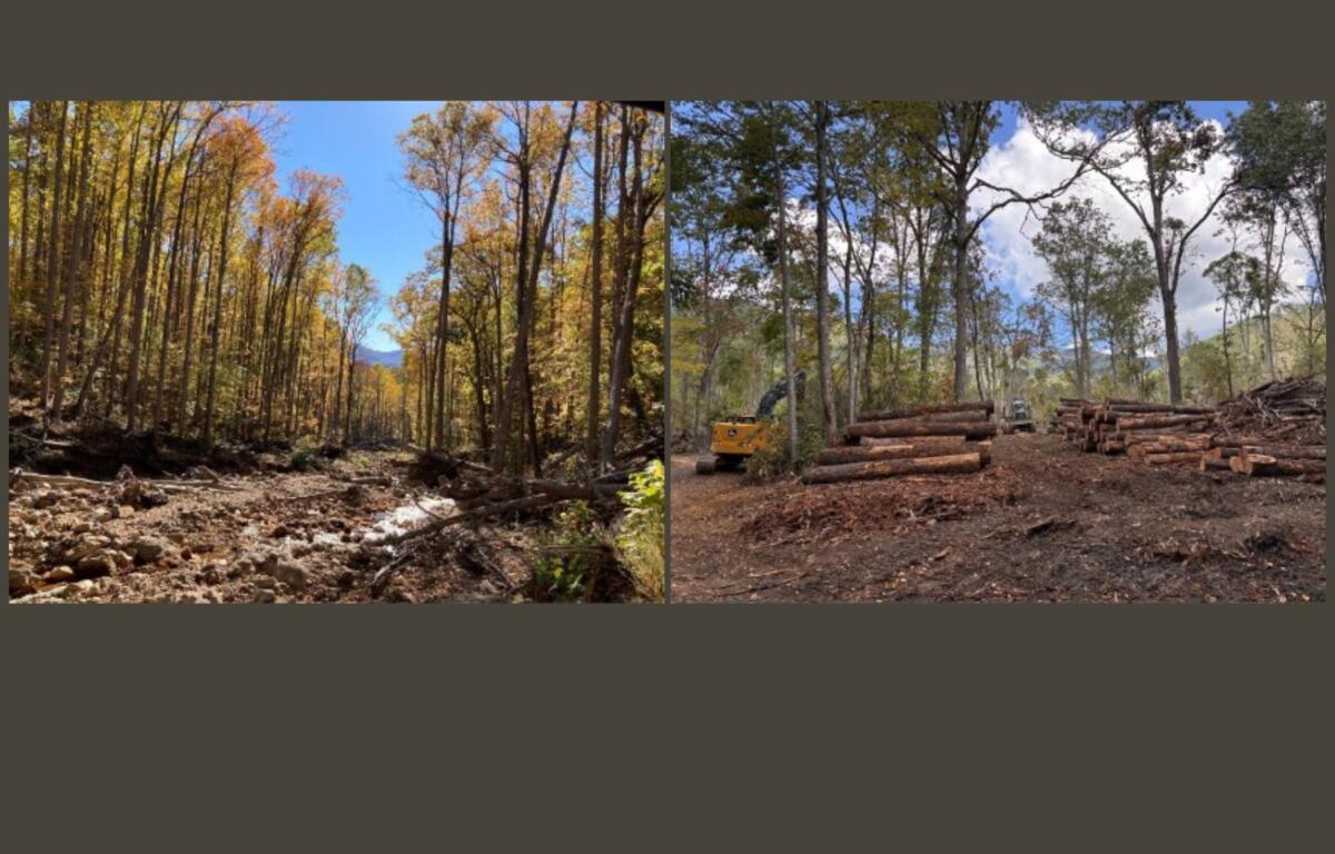
Forest Service officials said their top priorities include fuel and debris removal, restoring emergency responder access and reopening trails, roads and recreation areas.
At Shope Creek, crews have reduced about half of hazardous fuel loads left behind by the storm. Officials said the work has improved emergency access for search-and-rescue crews and wildfire response teams.
Additional work in the area has included road and stream crossing improvements, invasive species treatment and site preparation for revegetation. Reforestation planting took place in spring 2026.
Parts of Shope Creek have partially reopened, including parking lots and roads, though most of the area remains closed to the public.
The Forest Service is also moving forward with long-term trail planning at Shope Creek. Officials said the goal is to create a multi-use trail system for hikers and mountain bikers while minimizing user conflicts and protecting forest resources.
Plans call for combining existing and new trails, incorporating public input and coordinating with local emergency responders. Long-term maintenance and ongoing forest management efforts are also part of the strategy.
In Big Ivy, officials reported significant progress since the storm. All trails in the area reopened in October 2025 after more than 2,000 hours of sawyer work to clear debris.
Several roads have also reopened or undergone emergency repairs, including portions of Ranger Road, Lower Staire Road and Ogle Meadows Road. Debris removal and restoration work has also been completed near Stoney Fork Road.
Watershed assessments have been finished in the area, and officials said debris removal efforts have helped reduce future flooding risks.
Looking ahead, the Forest Service plans to restore vehicle access to Douglas Falls. Currently, drivers can only reach the intersection of Ranger Road and Coleman Boundary Road.
A contract for the project is expected to be awarded during fiscal year 2026, with reopening targeted for summer 2027 for high-clearance vehicles.
Federal Highway Administration crews are also expected to begin long-term resiliency and road realignment work along Coleman Boundary Road in fiscal year 2027. Officials said that process will include environmental review and opportunities for public input.