
ASHEVILLE, N.C. (828newsNOW) — Memorial Day weekend marks the unofficial start of summer, and, for many Western North Carolinians, that means loading the car and heading to the beach, the mountains or a family gathering. This year, however, travelers may have to navigate more than just holiday traffic.
Forecasters are calling for periods of rain and scattered thunderstorms across Western North Carolina through the holiday weekend, creating the potential for slick roads, reduced visibility and slower travel times. Combined with active construction zones and one of the busiest travel weekends of the year, the weather could make patience just as important as a full tank of gas.
The Friday before Memorial Day is traditionally among the busiest driving days of the year as millions of Americans begin long-weekend trips. Travel forecasts from the American Automobile Association show the heaviest traffic typically occurs Thursday and Friday afternoons before the holiday and again Monday as travelers head home.
Transportation experts generally recommend leaving before noon on Friday or waiting until early Saturday morning to avoid the worst congestion.
In North Carolina, motorists are getting some relief from construction-related delays. The North Carolina Department of Transportation suspended most temporary lane closures on major highways through the holiday travel period to help keep traffic moving. Even so, drivers in the Asheville area should still expect active work zones, reduced speed limits and occasional slowdowns tied to several long-term projects.
Among the biggest ongoing projects is the widening of Interstate 26 between Asheville and Hendersonville. Construction also continues on the I-26 Connector project through Asheville and along portions of Interstate 40 west of the city. While temporary lane closures may be reduced for the holiday, those work zones remain in place.
Drivers should also be aware of permanent traffic pattern changes associated with the I-26 Connector project. The Riverside Drive entrance ramp to I-26 and I-240 and the Hill Street exit ramp from I-26 and I-240 have been permanently closed, requiring motorists to follow posted detours. Additional changes around the Patton Avenue and Westgate Bridge area continue as construction advances.
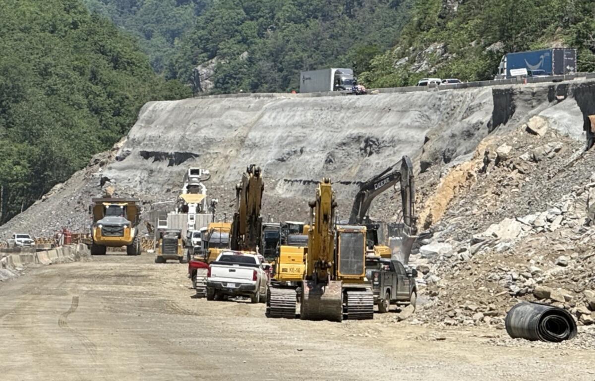
For travelers heading toward Tennessee, the rebuilt I-40 corridor through the Pigeon River Gorge remains open but continues to operate through an active construction zone. Narrow lanes, reduced speeds and lane shifts remain in place, and holiday traffic volumes could create significant backups, particularly Friday afternoon and Monday.
Rain could make those conditions even more challenging.
Transportation officials urge motorists to allow extra travel time, increase following distance and turn on headlights whenever windshield wipers are in use. In the mountains, sudden downpours and fog can quickly reduce visibility, while wet pavement increases stopping distances and the likelihood of crashes.
Fortunately, drivers have more tools than ever to stay ahead of trouble spots.
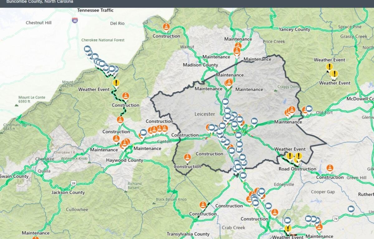
The state’s official resource, DriveNC.gov, provides real-time information on crashes, road closures, construction zones, flooding and traffic camera feeds across North Carolina. Travelers can also access updates through the NCDOT Traveler Information Management System app and the state’s 511 traveler information network.
Navigation apps can provide another layer of information.
Google Maps combines government traffic data with reports from drivers to identify crashes, construction zones and delays while calculating alternate routes. Waze relies heavily on crowd-sourced reports and often provides some of the quickest notifications about crashes, disabled vehicles, hazards and traffic backups. Apple Maps also offers real-time traffic information, closure alerts and alternate route suggestions for iPhone users.
Weather information can be just as valuable as traffic reports during a busy holiday weekend. The National Weather Service offices serving Western North Carolina provide updated forecasts, radar imagery and severe weather alerts that can help travelers avoid the worst conditions before leaving home.
Local law enforcement agencies, emergency management offices and NCDOT social media accounts also frequently post updates on major crashes, road closures and weather-related travel problems.
For many Asheville-area travelers, using a combination of resources offers the best chance of avoiding delays. DriveNC provides official information on construction and closures, Waze can quickly alert drivers to crashes and slowdowns, and Google Maps remains one of the most effective tools for route planning and travel-time estimates.
That combination may prove especially useful this Memorial Day weekend as rain, construction and holiday traffic converge on some of Western North Carolina’s busiest corridors.
A quick check of traffic and weather conditions before heading out could mean the difference between reaching a destination on schedule and spending part of the holiday stuck in traffic.