
HENDERSONVILLE, N.C. (828newsNOW) – As out-of-control wildfires continue to mount their scorched earth campaign across Western North Carolina, travel is becoming increasingly difficult. A major roadway could soon be closed.
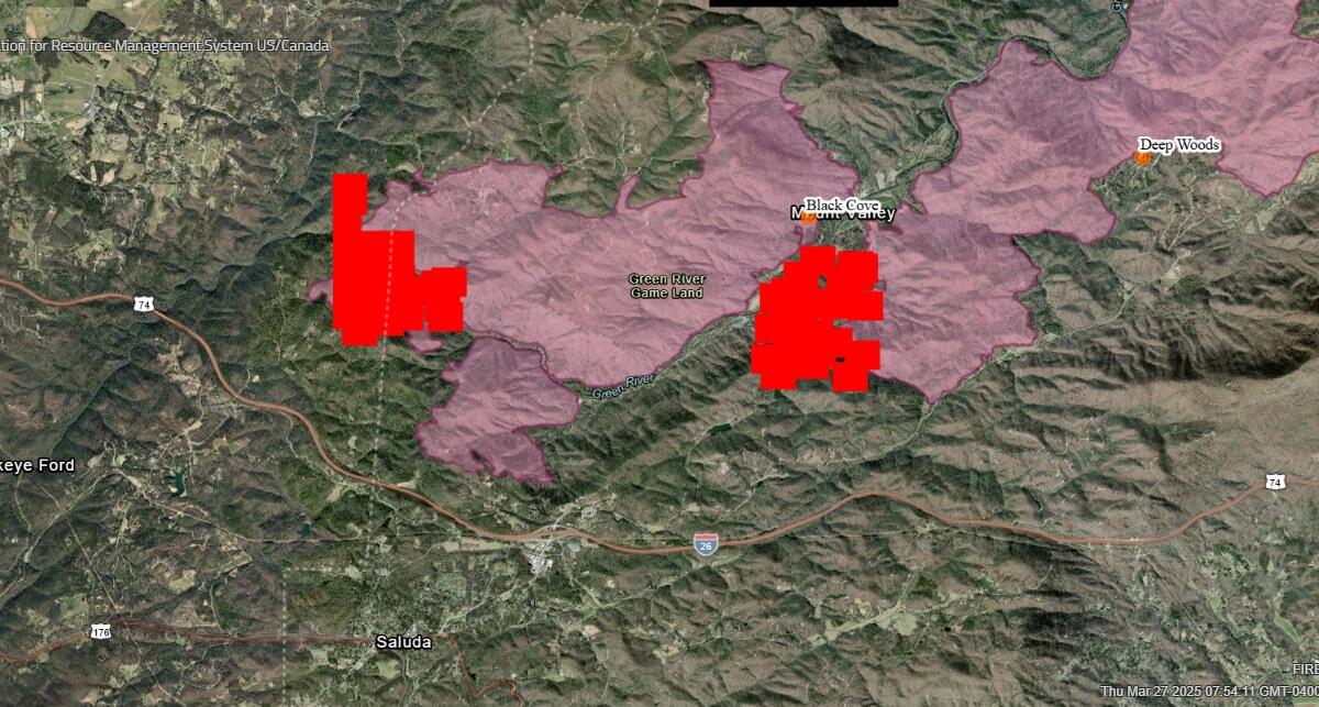
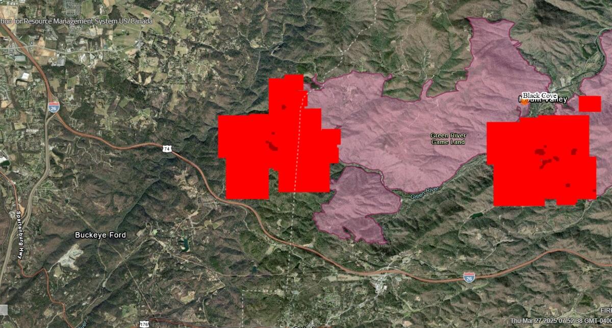
The section of Interstate 26 running through the Green River Gorge is being threatened by the Black Cove and Deep Woods wildfires, each over 3,000 acres in size. Based on imaging available on the NASA FIRMS/Canada map, the fires burning in Henderson County are within striking distance of the interstate, perhaps as close as one mile in sections.
A flying restriction has been placed over the Henderson county wildfires from surface level to 5,500 feet. This ban includes all drone traffic.
A statewide burn ban is in effect. Do not burn anything outside.