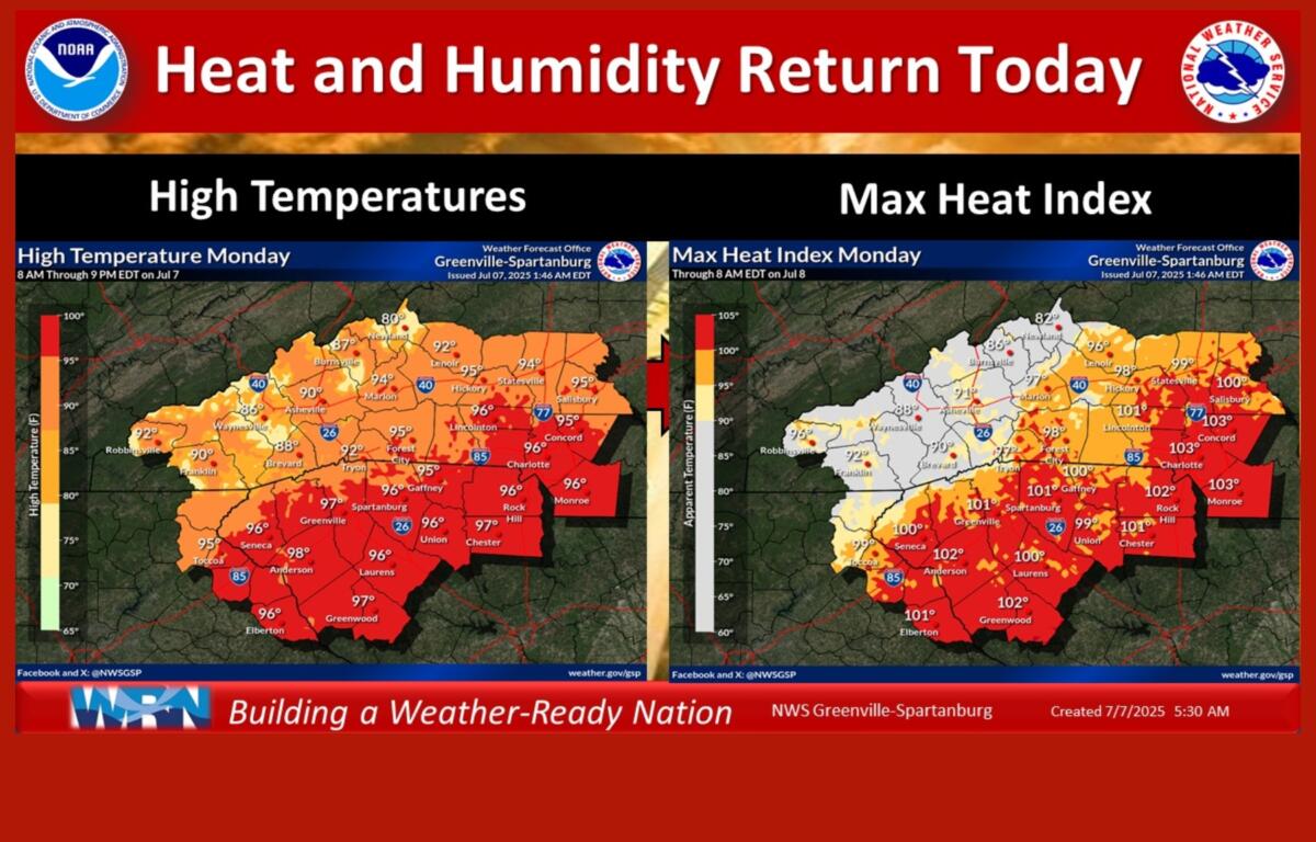

ASHEVILLE, N.C. (828newsNOW) — A wave of heat and humidity returns to the region Monday and is expected to push temperatures into the 90s across much of Western North Carolina, including many mountain valleys. Heat index values are expected to exceed 100 degrees, especially along and south of the Interstate 85 corridor.
The National Weather Service is urging residents to take precautions against heat-related illness and limit outdoor activity during the hottest parts of the day.
There is a 30 percent chance of showers and thunderstorms Monday afternoon, mainly after 2 p.m., with increasing cloud cover and a high near 91 degrees. Winds will be light and variable, and rainfall totals are expected to remain below a tenth of an inch, although locally heavier downpours are possible in thunderstorms.
Tonight, the chance of storms drops to 30 percent, mainly before 7 p.m., with skies gradually clearing overnight. The low will be around 66.
The unsettled weather pattern continues into Tuesday, with a 60 percent chance of showers and thunderstorms after 2 p.m. Skies will turn mostly cloudy by afternoon, and temperatures will again reach the low 90s. A light west wind is expected.
Showers and thunderstorms remain in the forecast through the rest of the week, with precipitation chances climbing as high as 80 percent on Wednesday, Thursday and Friday. Daily highs will range from the mid-80s to near 90 degrees, with overnight lows in the mid-60s.
Periods of heavy rain may occur with some storms, potentially leading to localized flooding in low-lying areas.