



ASHEVILLE, N.C. (828newsNOW) — After several days of soaking rain that flooded roads, triggered landslides and washed out vulnerable infrastructure across Western North Carolina, forecasters say the threat of widespread flooding is beginning to ease — though afternoon thunderstorms and localized flooding remain possible through the end of the week.
Communities across Buncombe, McDowell, Henderson, Rutherford and Transylvania counties spent Tuesday assessing damage from heavy rainfall that fell across the region during the Memorial Day weekend and into this week.
In Fairview, officials announced the closure of Bearwallow Mountain Road between North Bearwallow Road and Old Clear Creek Road through Thursday because of storm-related damage. Residents can still access their homes from either side of the closure, according to the Fairview Volunteer Fire Department.
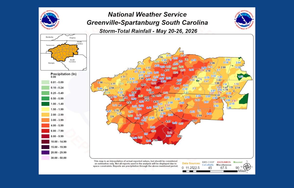
The rain has been particularly heavy in McDowell County, where a network of weather stations recorded more than 8 inches of rainfall in some locations since May 21.
The highest total was measured at the McDowell County Emergency Operations Center, which reported 8.44 inches. Marion Fire Department recorded 7.91 inches, while several other stations reported between 5 and 7.5 inches of rain.
Emergency officials said flash flooding was reported Monday night along Thompsons Fork on Roland’s Chapel Road. No injuries were reported.
“Turn around, don’t drown” remained the message from emergency managers, who urged drivers to avoid flooded roadways and monitor weather conditions as additional storms develop later this week.
Farther west, residents in Chimney Rock said the town escaped major damage despite high water and runoff.
A social media post from Village Scoop in Chimney Rock showed swollen waterways but reported that the community avoided significant impacts. Some roads and areas weakened by previous storms washed out, but businesses and residents reported no major flooding within town limits.
The latest round of rain has been particularly concerning for communities still recovering from the devastating impacts of Tropical Storm Helene.
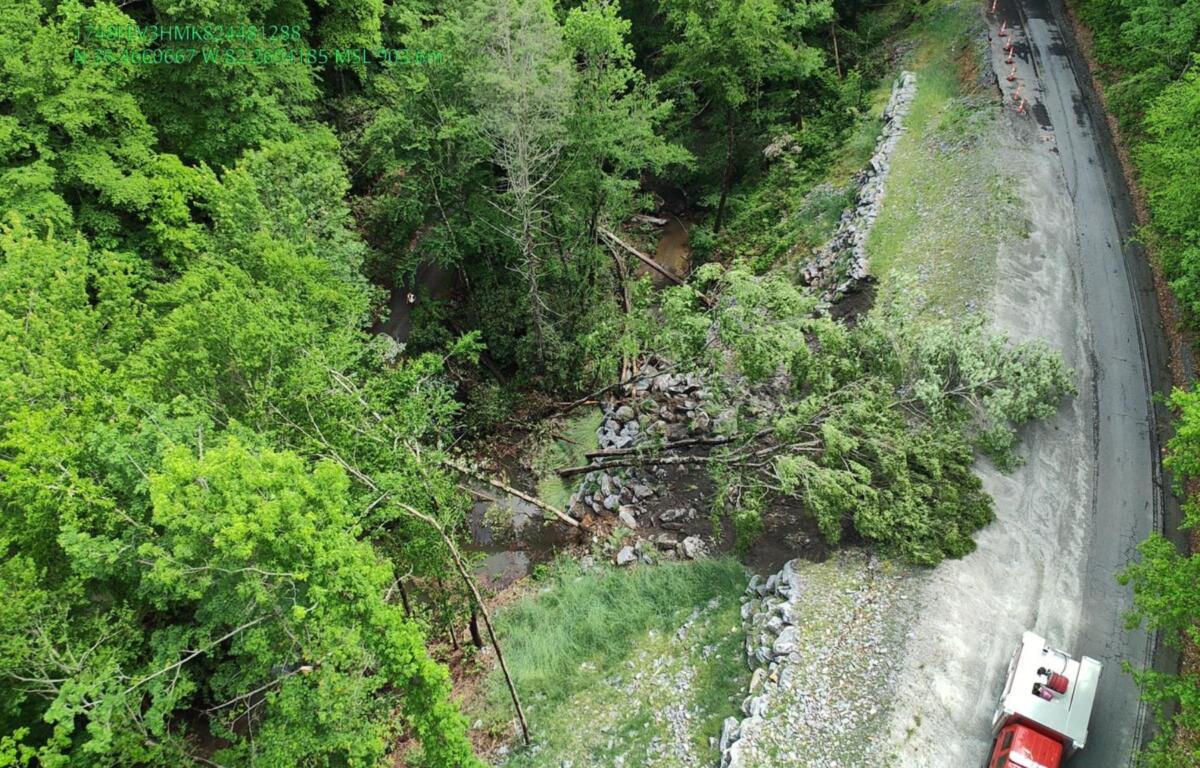
Along Shumont Road near Lake Lure, officials with Broad River Fire & Rescue reported a new slope failure in an area already undergoing repairs from previous storm damage. Several trees fell into a nearby waterway, raising concerns about additional erosion and potential impacts to the H&H Trail.
Residents in that area reported receiving between 5.5 and 6 inches of rain over the past three days.
Volunteer relief organization Savage Freedoms Relief Operations said flooding, washouts and road damage were reported in portions of Hickory Nut Gorge, Bearwallow, Bat Cave, Gerton and Fairview.
The group urged people not to travel into affected areas unless specifically requested to assist.
“Emergency services, DOT, local fire departments, and road crews are on it,” the organization said in a public update. “Congestion only makes it harder for the people already working to get through.”
Meanwhile, the National Weather Service issued a Flood Advisory on Wednesday morning for the French Broad River near Grove Bridge Road in Blantyre.
At 4 a.m., the river stood at 14.9 feet and was slowly rising toward an expected crest of 15.5 feet later Wednesday morning. Flood stage is 16 feet, but forecasters said low-lying farm fields near the river could experience minor flooding as water levels approach action stage.
Meteorologists said river levels rose overnight because of runoff from Tuesday’s rainfall.
The weather pattern is gradually shifting from the prolonged heavy-rain setup seen earlier this week toward a more typical late-spring pattern.
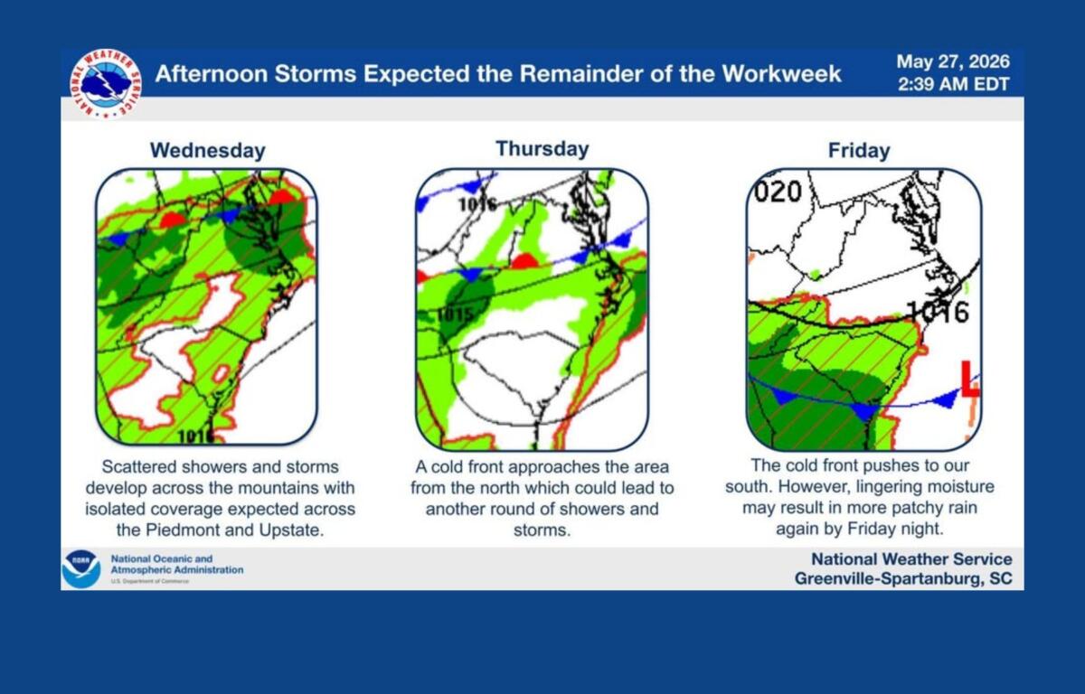
Forecasters expect scattered afternoon and evening thunderstorms each day through at least Friday. While localized heavy downpours remain possible, atmospheric moisture levels are expected to be lower than earlier this week, reducing the overall flood threat.
A few storms could become strong enough to produce damaging wind gusts, especially Wednesday and Thursday afternoons.
Additional rounds of rain remain possible heading into the weekend as another weather system approaches the Carolinas. Forecasters say confidence remains low on exactly how that system will develop, but conditions are expected to remain unsettled through at least early next week.
For many mountain residents, the repeated rainfall serves as another reminder of how vulnerable the region remains months after Helene reshaped roads, slopes and riverbanks across Western North Carolina.
Emergency officials continue to urge residents to monitor forecasts closely, avoid flooded roadways and report storm damage to local authorities.