



ASHEVILLE, N.C. (828newsNOW) — Hot and muggy weather will stick around across the Asheville area through the weekend, with temperatures climbing into the low 90s and heat index values approaching 100 degrees.
The National Weather Service in Greenville-Spartanburg said triple-digit heat index values are expected across much of the lower elevations through the weekend and into early next week.
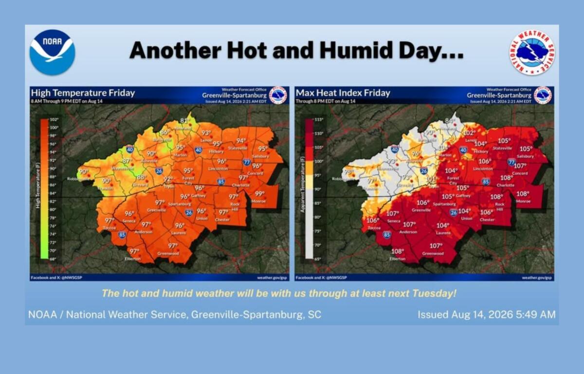
In Asheville, Friday’s forecast calls for a high near 91 degrees with a 30 percent chance of showers and thunderstorms, mainly between 2 and 4 p.m. Patchy fog is possible early in the morning.
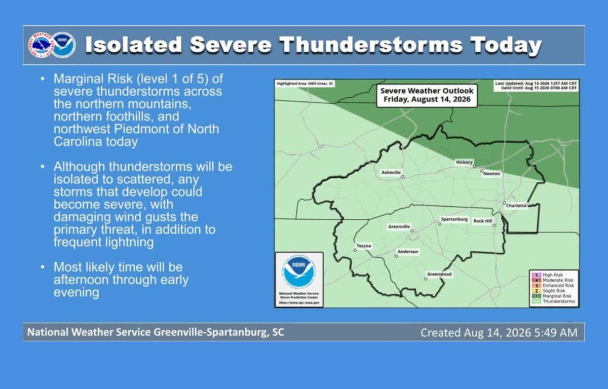
A few strong to severe thunderstorms also could develop Friday, mainly along and north of Interstate 40 in North Carolina. The primary threat from any severe storms will be damaging winds.
Friday night will be partly cloudy with patchy fog developing after 2 a.m. The low is expected to be around 70 degrees.
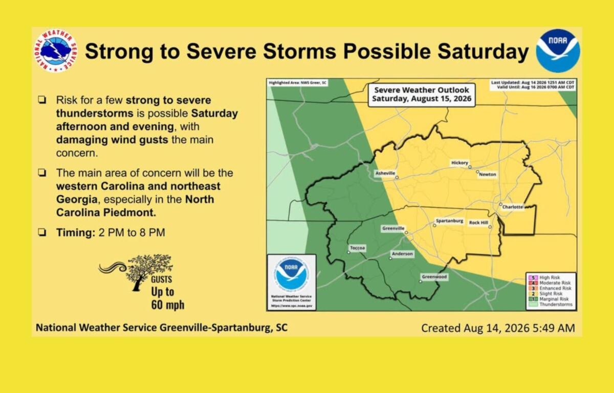
Saturday will be mostly sunny with a high near 92 degrees. The heat index could reach 100. There is a 30 percent chance of showers and thunderstorms, mainly after 5 p.m.
Saturday could bring a slightly higher risk of severe weather, according to the National Weather Service, as a weak frontal boundary approaches from the north. The main threat again will be damaging winds.
Storm chances continue Sunday, with a 30 percent chance of afternoon and evening thunderstorms and a high near 92 degrees.
Forecasters expect scattered showers and thunderstorms each afternoon through the weekend and into early next week. Some storms could be strong to severe, while isolated nuisance flooding also is possible.
Mountain valleys could see another round of patchy fog during the morning hours, which could create some temporary reductions in visibility.
For Asheville, the current forecast calls for the hot and unsettled pattern to continue, with afternoon storms providing the main chance for rain and some relief from the heat.