


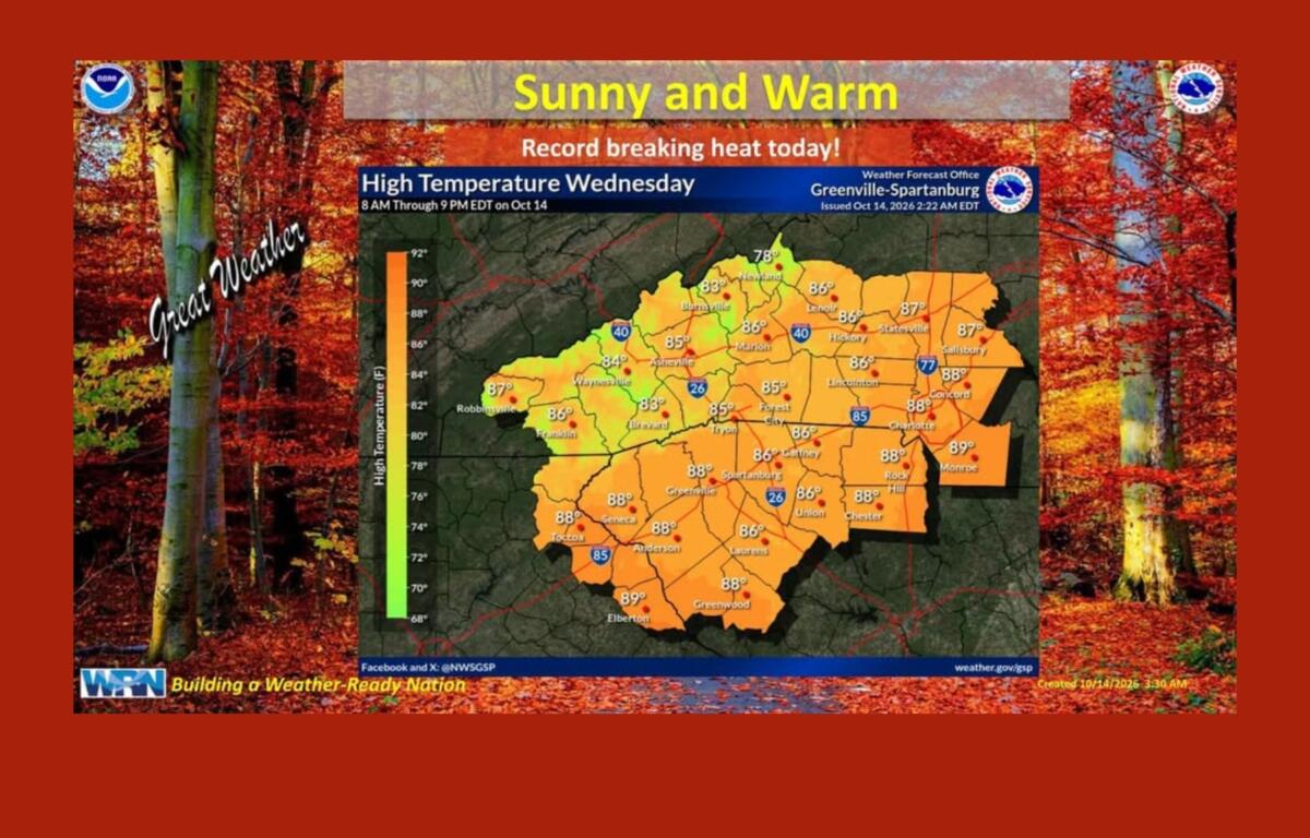

ASHEVILLE, N.C. (828newsNOW) — Asheville could break a nearly century-old temperature record Wednesday, but anyone enjoying the unusually warm weather might want to keep a jacket handy. A strong cold front is expected to send temperatures tumbling by the weekend, bringing the possibility of frost and freezing temperatures to parts of Western North Carolina.
The National Weather Service is forecasting a high of 86 degrees Wednesday, Oct. 14, well above the record of 82 degrees set in 1928.
Thursday could be another record-setting day, with a forecast high of 86 degrees. That would tie the record set in 1897.
The unusually warm weather is expected to continue into Friday, when Asheville could reach 81 degrees. But a strong cold front moving through Friday night will bring a big change.
By Saturday, Asheville’s high is expected to reach only 60 degrees — a drop of about 20 degrees from Friday. Sunday won’t be much warmer, with a forecast high of 61.
The colder air could also bring the season’s first widespread frost to parts of the mountains.
The Weather Service says temperatures could fall to freezing or below in some northern mountain communities early Sunday. Forecasters put the chances of reaching 32 degrees or lower at roughly 50% in the northern mountains.
Even mountain valleys that stay above freezing could get cold enough for frost.
Asheville’s forecast low Sunday morning is around 36 degrees, but colder temperatures are possible in outlying areas and higher elevations.
The Weather Service says frost advisories or freeze warnings may be needed as the weekend approaches.
The cold front could also bring gusty winds Friday night and early Saturday, particularly at higher elevations. Mountain peaks above 6,000 feet could see gusts strong enough to warrant a wind advisory, although forecasters say that remains uncertain.
Rain isn’t expected to be much of a factor. A few showers are possible Friday afternoon and evening, mainly in the western mountains near the Tennessee border. Most of the region is expected to stay dry.
Despite the colder temperatures, both Saturday and Sunday should be sunny.
The chilly weather is expected to continue into early next week, with Monday morning temperatures also running well below normal. Temperatures should gradually climb as the week progresses, although they are expected to remain on the cool side of normal.