


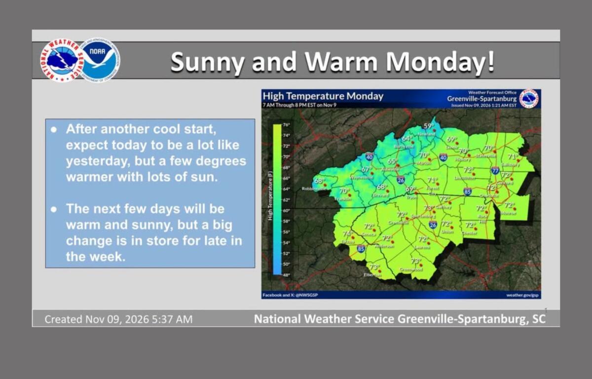

ASHEVILLE, N.C. (828newsNOW) — Western North Carolina is in for a little bit of everything this week, from sunny skies and afternoon temperatures near 70 degrees to a blast of cold air that could bring accumulating snow to the mountains.
The National Weather Service says the week will get off to a pleasant start, with plenty of sunshine and temperatures running 5 to 10 degrees above normal through Wednesday. But don’t let the warmer afternoons fool you. Chilly nights are still in the forecast, and a much bigger change is coming later in the week.
Asheville will see sunny skies Monday with a high near 66 degrees before temperatures drop to around 31 overnight. Frost is possible again in parts of the region, particularly across the North Carolina foothills and northwest Piedmont.
Tuesday looks even warmer, with sunshine and a high near 70. Veterans Day on Wednesday should bring more pleasant weather, with mostly sunny skies and a high around 69.
Then things take a turn.
A strong cold front is expected to move through the region Thursday, bringing increasing chances of rain and ushering in some of the coldest air of the fall season.
Asheville has a 50 percent chance of rain Thursday, with a high near 60. By Friday, the high is expected to reach only 44 degrees, with breezy conditions making it feel even colder.
The cold weather will stick around through the weekend. Asheville could see lows around 27 degrees Friday night and 26 Saturday night, with Saturday’s high reaching only about 45.
Temperatures across the region could fall more than 10 degrees below normal Friday and into the weekend.
Mountain snow becomes a possibility
The biggest concern with the approaching system is the potential for accumulating snow in the higher elevations of Western North Carolina.
Snow showers are expected to develop as colder northwest winds push moisture against the mountains. Accumulation is most likely above 3,500 feet along the Tennessee border, although some nearby valleys could also see snow.
The National Weather Service says confidence is increasing that accumulating snow will occur in the higher elevations, but exact amounts remain uncertain.
Local meteorologists say several inches of snow could accumulate in the higher elevations near the Tennessee border and a light dusting on grassy or elevated surfaces could even be possible in some lower elevations, including around Asheville, by Sunday morning.
That possibility remains uncertain, however, and the National Weather Service has not forecast accumulating snow for Asheville.
Freezing temperatures could reach much of the region
Even areas that don’t see snow will feel the change.
Forecasters say many areas that have yet to experience a freeze this fall could see temperatures fall below 32 degrees by the weekend.
For Asheville, the forecast calls for a low around 31 degrees Thursday night, followed by a chilly and breezy Friday.
The National Weather Service says the colder pattern could stick around through at least Saturday night.
For now, Western North Carolina has a few more days of mild weather before temperatures take a sharp turn toward winter.