



ASHEVILLE, N.C. (828newsNOW) — Hot and humid weather will stick around across Western North Carolina this week, with another round of thunderstorms possible Monday afternoon and evening.
The National Weather Service Greenville-Spartanburg office said heat index values could again climb into the triple digits Monday and Tuesday, particularly across lower elevations.
Forecasters are urging people to avoid strenuous outdoor activity during the hottest part of the day, take frequent breaks and stay hydrated.
For Asheville, Monday’s high is expected to reach about 91 degrees. There is a 30 percent chance of showers and thunderstorms, mainly after 5 p.m.
The more significant weather concern Monday will come later in the day.
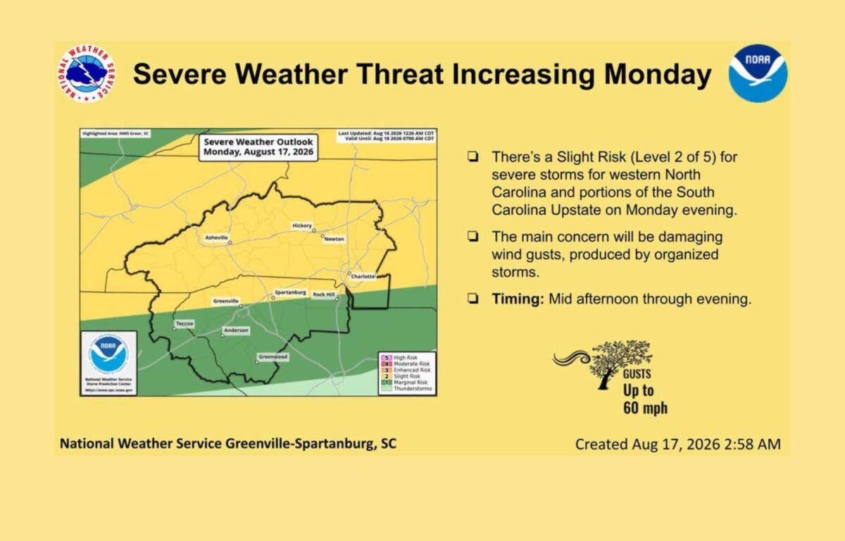
The weather service has placed Western North Carolina under a slight risk for severe weather Monday evening. Storms are expected to develop in the mountains late Monday afternoon into the evening before potentially moving into the Piedmont and Upstate South Carolina later in the evening.
Damaging wind gusts will be the main severe weather threat, forecasters said.
Storm activity is expected to develop as a weakening cold front moves across the Tennessee Valley and into the Appalachians.
While the exact coverage of storms remains uncertain, forecasters said the atmosphere could support some organized thunderstorms. The severe threat should decrease as storms move farther east.
For Asheville, showers and storms will remain possible through about 11 p.m. Monday. The low is expected to drop to around 69 degrees, with patchy fog developing overnight.
A little relief, but not much
The heat is not going away anytime soon.
The weather service said hot and muggy conditions are expected to continue through much of the week, with little relief until next weekend.
Tuesday should be somewhat cooler in Asheville, with a high near 87 degrees. Skies are expected to gradually clear after a cloudy start.
Wednesday will be sunny with a high near 91.
Thursday will bring another chance of afternoon thunderstorms, with a high near 92.
Friday looks cooler, with a high near 88 and a 70 percent chance of showers and possibly a thunderstorm after 2 p.m.
Forecasters are watching for a cold front that could reach the Carolinas Friday or Saturday. If it moves through as expected, it could bring more showers and thunderstorms — and potentially cooler temperatures heading into next weekend.
For now, though, residents should expect several more days of summer heat and humidity.