



ASHEVILLE, N.C. (828newsNOW) — Buncombe County officials are urging residents to hold off on outdoor burning through Monday, Oct. 19, as gusty winds and dry vegetation increase the risk of fires spreading.
The Buncombe County Fire Marshal’s Office issued the advisory Thursday, Oct. 15, warning that dry grass, fallen leaves and other yard debris could easily catch fire and spread quickly.
The advisory is not a burn ban, but officials are asking residents to postpone burning yard debris until conditions improve.
Anyone who must burn outdoors should keep fires small, never leave them unattended and have a way to extinguish them nearby. Fires should be kept at least 25 feet from buildings and combustible vegetation.
Officials also urge caution when using machinery and farm equipment that could produce sparks.
Only natural vegetation may be burned, and burning is prohibited in areas with public yard waste collection, including Asheville and other municipalities.
Residents can check whether burning is allowed by calling the county’s Open Burning Hotline at 828-250-6767 or visiting buncombenc.gov.
Dry conditions persist in Western North Carolina
The warning comes as parts of Western North Carolina continue to experience dry conditions.
The latest U.S. Drought Monitor, released Thursday, Oct. 15, classifies Buncombe County as abnormally dry, while Haywood, Jackson, Macon, Swain and Transylvania counties remain in moderate drought.
Although recent rainfall has helped ease dry conditions in parts of the mountains, gusty winds and dry vegetation can still create conditions that allow fires to spread quickly.
Cold front to bring gusty winds, sharp temperature drop
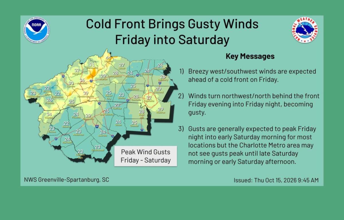
The burning advisory comes ahead of a strong cold front expected to move through Western North Carolina late Friday into early Saturday.
The National Weather Service says the front will bring gusty winds, especially at higher elevations, along with a dramatic drop in temperatures.
Asheville is expected to reach 82 degrees Friday before temperatures fall into the 40s overnight.
By Saturday, the high is expected to reach only 57 degrees, about 25 degrees cooler than Friday. Northwest winds could gust as high as 32 mph.
A few showers are possible Friday night and Saturday morning, but rainfall amounts are expected to be minimal.
The colder air could also bring widespread frost to the mountains Saturday night into Sunday morning, with freezing temperatures possible in parts of the northern mountains.
Asheville’s overnight low Saturday is forecast to drop to around 35 degrees.
The change follows an unusually warm stretch across the region. Asheville reached 84 degrees Wednesday, Oct. 14, breaking the previous record of 82 degrees.
Sunday is expected to be sunny with a high near 59 degrees. Temperatures should gradually return to seasonal averages by the middle of next week.