
ASHEVILLE, N.C. (828newsNOW) — The threat of heavy rain and strong thunderstorms is increasing across Western North Carolina as a cold front moves into the region, bringing multiple rounds of unsettled weather through Thursday.
Forecasters with the National Weather Service say storms could intensify Wednesday afternoon and evening, with the greatest risk focused on the mountains, including far western North Carolina, and into northeast Georgia. Those areas face a Level 2 out of 5 risk for severe weather, while most of the rest of the region is under a Level 1 risk.
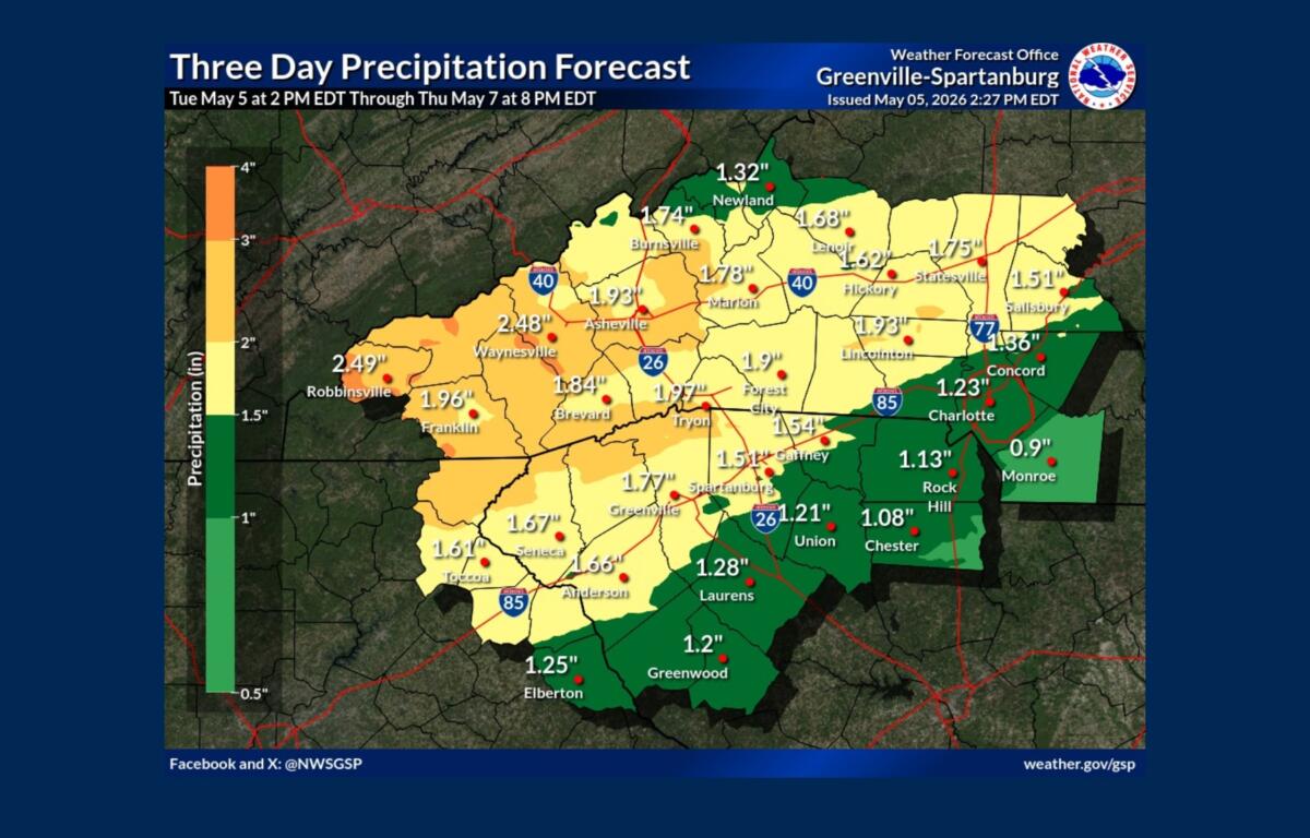
Rainfall totals of 1 to 2 inches are expected through Thursday morning, with the highest amounts likely in the mountains. While the rain is expected to be beneficial overall, especially after recent dry conditions, forecasters warn that heavier downpours could lead to isolated flooding, particularly in low-lying or urban areas.
The first round of showers and a few storms may move through the mountains Wednesday morning, but stronger storms are expected to develop later in the day to the west and track into the area by late afternoon and evening.
Damaging wind gusts and large hail are the primary threats, though the risk of tornadoes appears low at this time. Storms could organize into lines as they move east, continuing into the overnight hours before tapering off early Thursday.
Another round of scattered storms is possible Thursday afternoon, especially along and south of the Interstate 85 corridor. These storms are expected to be less intense but could still produce gusty winds.
After the system moves through, drier weather is expected to return briefly before rain chances increase again late in the weekend and into early next week.
Temperatures will remain near seasonal averages for early May, with a brief cooldown behind the front before conditions rebound.