



ASHEVILLE, N.C. (828newsNOW) — Keep the umbrella handy this week.
Scattered showers and thunderstorms are expected across the Asheville area through much of the week, with rain chances running above normal and temperatures generally staying a few degrees below average.
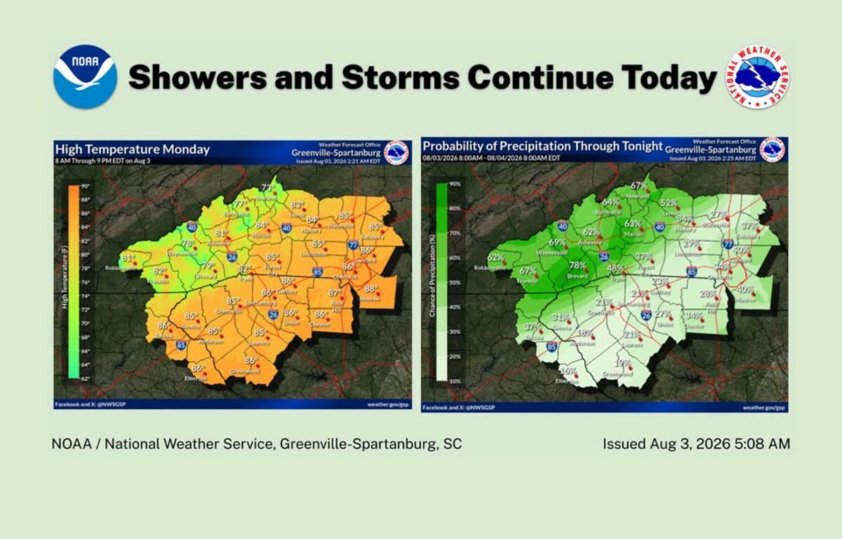
The National Weather Service office in Greenville-Spartanburg said another round of afternoon showers and thunderstorms is expected Monday, particularly across the mountains. Areas east of the mountains should see only isolated to widely scattered storms.
An unsettled weather pattern is expected to stick around through at least the middle of the week as an upper-level low settles over the Southern Appalachians.
For Asheville, the forecast calls for a 60 percent chance of rain Monday, with showers and thunderstorms most likely after 3 p.m. The high should reach about 82 degrees, with a low near 65 Monday night.
Rain chances increase Tuesday, with an 80 percent chance of showers and thunderstorms and a high near 81. Another 40 percent chance of showers and storms is expected Tuesday night.
Wednesday will also be wet, with an 80 percent chance of showers and thunderstorms and a high near 81. The chance of rain drops somewhat Wednesday night, but showers could linger into the evening.
Thursday brings another 80 percent chance of showers and thunderstorms, with a high near 84. Friday will remain unsettled, with a 70 percent chance of showers and thunderstorms and a high near 84.
Heavy rain possible
The repeated rounds of showers and thunderstorms could produce locally heavy rainfall, according to the National Weather Service.
That could lead to isolated flash flooding, particularly in areas that receive several rounds of rain. Forecasters said the flood threat is expected to remain localized rather than widespread.
An isolated strong to marginally severe storm also cannot be ruled out on any given day, with locally damaging winds possible. However, forecasters said the overall weather pattern is not expected to support a widespread or organized severe-weather threat.
Fog could return
Morning fog and low clouds will also be possible, particularly in mountain valleys.
Some areas could see reduced visibility after periods of heavier rainfall, and fog could create travel concerns during the morning commute.
At Asheville Regional Airport, daily showers and thunderstorms could lead to periodic flight restrictions through at least the middle to latter part of the week.
For now, the forecast is simple: Rain chances are sticking around, so don’t leave the umbrella at home.on is 70%.