


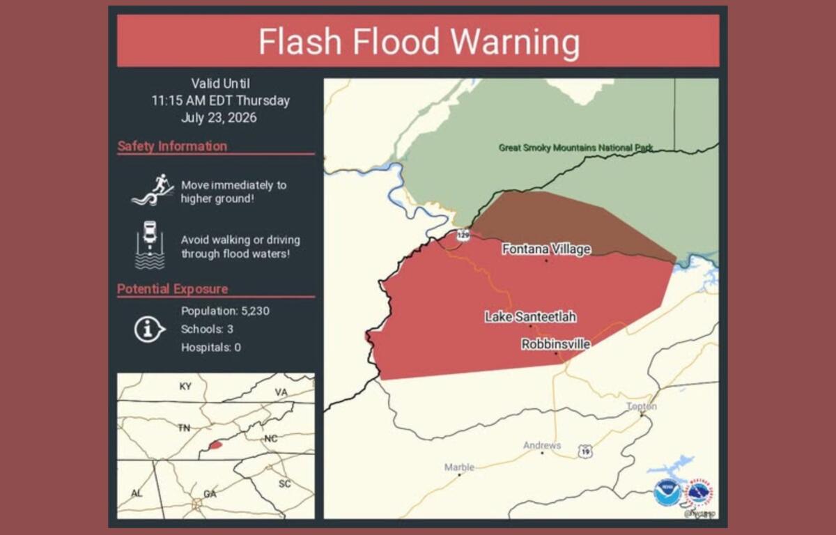

ASHEVILLE, N.C. (828newsNOW) — A Flash Flood Warning has been issued for parts of Western North Carolina after thunderstorms dropped as much as 5 inches of rain, while a Flood Watch remains in effect through 8 p.m. Thursday for Asheville, Buncombe County and much of the mountains.
The National Weather Service issued the Flash Flood Warning at 8:21 a.m. Thursday for northern Graham County and west-central Swain County, including Robbinsville, Lake Santeetlah and Fontana Village. The warning remains in effect until 11:15 a.m.
Forecasters said radar and rain gauges showed 3 to 5 inches of rain had already fallen, with flash flooding ongoing or expected to begin shortly. The greatest concern is from Fontana Village to Tapoco, where small streams, low-lying areas, roads and poor drainage locations could quickly flood.
The weather service also warned that heavy rain increases the risk of landslides, particularly in areas with a history of slope failures. Residents near streams or at the base of mountains are urged to watch for moving soil, falling rocks or rapidly rising water and leave immediately if conditions become dangerous.
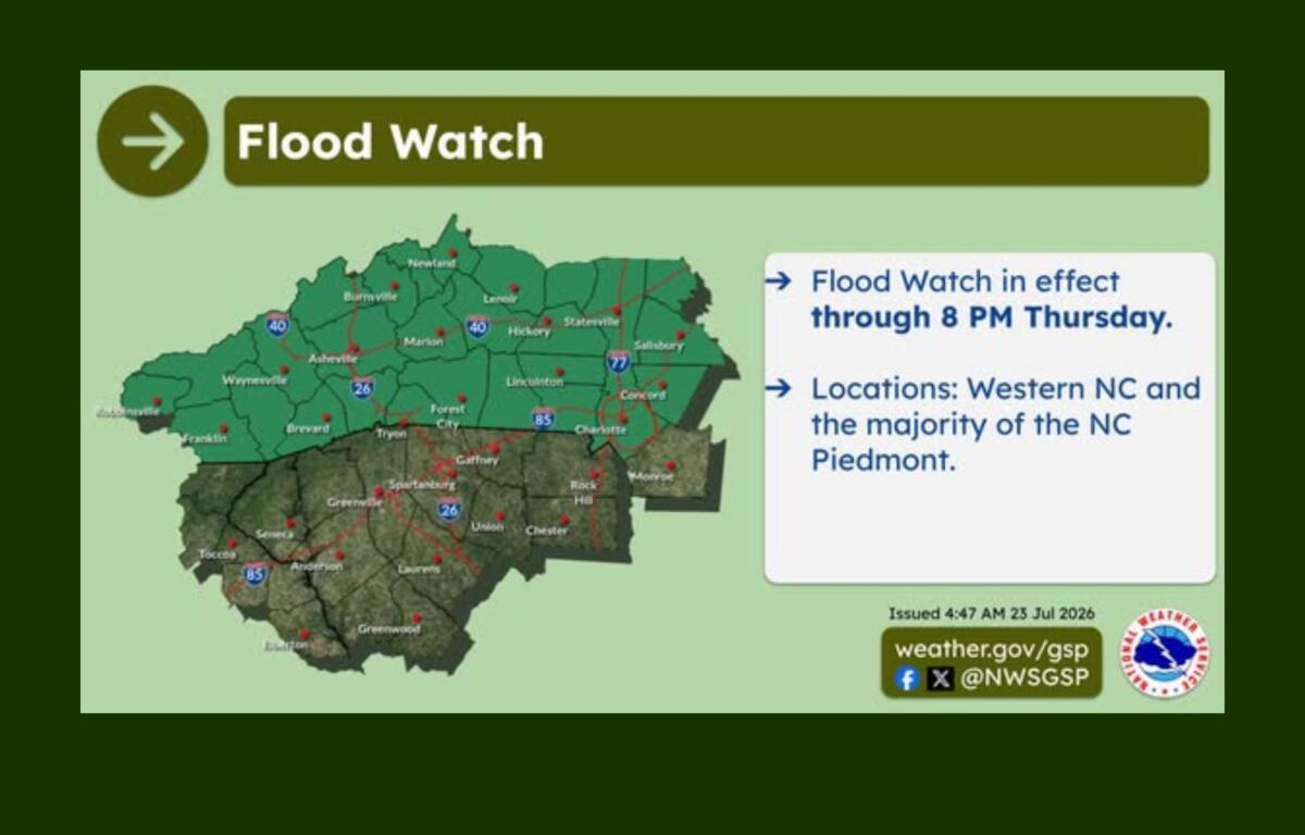
While the Flash Flood Warning is limited to Graham and Swain counties, a broader Flood Watch remains in effect through 8 p.m. Thursday for much of Western North Carolina, including Asheville, Buncombe, Haywood, Henderson, Madison, Transylvania, Yancey, Mitchell, Macon, Jackson and surrounding mountain counties.
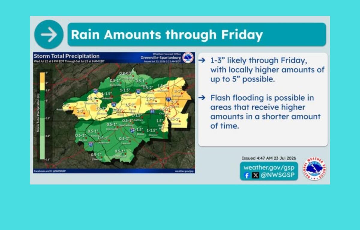
Forecasters expect 1 to 3 inches of additional rainfall through Friday, with isolated locations potentially receiving up to 5 inches where repeated thunderstorms develop.
The National Weather Service said excessive runoff could flood creeks, streams, urban areas and other flood-prone locations. While widespread flooding is not expected, localized flash flooding could develop wherever the heaviest rain falls in a short period.
Rain is expected to continue on and off Thursday as a slow-moving cold front interacts with deep tropical moisture. Meteorologists said uncertainty remains over exactly where the heaviest rainfall will occur, but the threat of flash flooding will continue through at least Friday.
Flooding problems have already developed elsewhere in North Carolina. According to North Carolina’s Weather Authority, localized flooding closed part of Interstate 85/40 in Orange County Thursday morning, and emergency crews responded to reports of flooded roads, vehicles trapped in water and downed trees.
The National Weather Service reminds drivers to never drive through flooded roadways. Most flood-related deaths occur in vehicles.
Residents can monitor the latest forecasts and warnings through the National Weather Service and be prepared to move to higher ground if a Flash Flood Warning is issued for their area.