


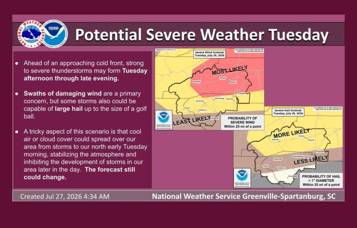

ASHEVILLE, N.C. (828newsNOW) — Western North Carolina could see strong to severe thunderstorms Tuesday afternoon and evening, with forecasters warning that damaging winds and large hail are possible if storms develop ahead of an approaching cold front.
The National Weather Service in Greenville-Spartanburg said confidence is growing that severe weather is possible Tuesday into early Wednesday, although exactly where the strongest storms will form remains uncertain.
The greatest threat is expected to be damaging straight-line winds, but some storms could also produce hail ranging from quarter-size to as large as golf balls. Frequent lightning and torrential downpours are also expected with any thunderstorms that develop.
“This is not a slam dunk,” the weather service cautioned Monday, noting that the forecast could still change depending on how conditions evolve Tuesday morning.
Meteorologists said one of the biggest questions is whether early morning clouds or leftover storms moving in from Tennessee will limit daytime heating. If they do, the atmosphere may not become unstable enough to support widespread severe weather. If skies clear and temperatures climb into the lower 90s, the risk for stronger storms will increase.
WYFF Chief Meteorologist Chris Justus said the combination of an approaching cold front, an upper-level disturbance and afternoon heat could create favorable conditions for severe thunderstorms.
“Not everyone will see severe weather,” Justus said in a social media update. “But the storms that do develop could pack a punch with damaging wind gusts, frequent lightning and heavy downpours.”
Justus also urged residents not to overlook the danger posed by lightning.
“If you hear thunder, you’re close enough to be struck by lightning, so head indoors immediately,” he said.
Tuesday is also expected to be the hottest day of the week, with highs near 91 degrees in Asheville and temperatures climbing into the lower to middle 90s across parts of the Piedmont. Heat index values could top 100 degrees in some locations east of the mountains before storms develop.
The Asheville forecast calls for a 30 percent chance of showers and thunderstorms after 3 p.m. Tuesday. Winds could gust to around 21 mph before storms arrive, with stronger gusts possible in and near thunderstorms.
Any storms should move out Tuesday night as the cold front pushes through the region.
Behind the front, cooler and less humid air is expected to settle into Western North Carolina. Wednesday’s high is forecast to reach about 84 degrees under mostly sunny skies, with overnight lows falling into the upper 50s by midweek. Dry weather is expected to continue through at least Friday.
Forecasters encourage residents to monitor the latest forecasts and have multiple ways to receive weather warnings in case severe thunderstorms develop Tuesday afternoon or evening.