



ASHEVILLE, N.C. (828newsNOW) — After a stormy stretch that included an EF-0 tornado in Madison County earlier this week, Western North Carolina is getting a brief break from severe weather before rain chances return this weekend.
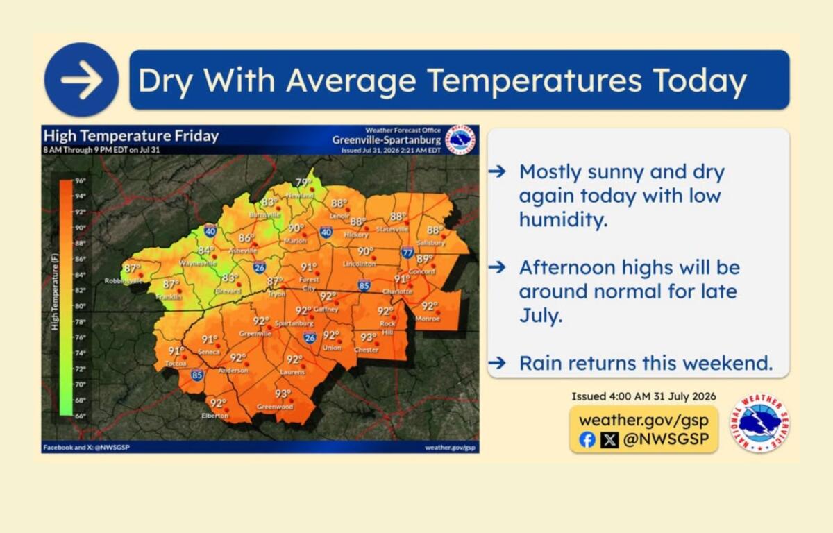
Friday is expected to bring mostly sunny skies, lower humidity and temperatures near normal for late July, according to the National Weather Service in Greenville-Spartanburg.
The calmer weather follows Tuesday’s tornado in the Allegheny community of Madison County. The National Weather Service rated the storm an EF-0, with estimated peak winds of 80 mph. The tornado was part of a round of storms that brought heavy rain and damaging winds across parts of the region.
For Asheville, Friday’s forecast calls for mostly sunny skies with a high near 87 degrees. Winds will be light, and humidity levels are expected to remain unusually low for this time of year.
“Dry weather with low humidity continues again today with afternoon high temperatures near normal for late July,” the National Weather Service said.
But the dry conditions will not last long.
A weather system moving in from the west is expected to bring increasing rain chances beginning Saturday and continuing into early next week.
Forecasters say a front could stall across the region, bringing a return of wetter weather, cooler-than-normal temperatures and the potential for locally heavy rainfall.
Saturday’s forecast for Asheville includes a 40 percent chance of showers and thunderstorms after 2 p.m., with a high near 84 degrees. Rain chances increase Saturday night, with a 70 percent chance of showers and storms.
Sunday is expected to be the wettest day of the weekend, with showers and thunderstorms likely and an 80 percent chance of rain. The high temperature is expected to stay near 81 degrees.
Meteorologists are watching for the possibility of slow-moving storms that could produce heavy rainfall and isolated flooding, especially in areas that receive repeated rounds of storms.
Recent rain helps drought conditions, but problems remain
While recent rainfall has brought flash flooding to some parts of North Carolina, state officials say it has also provided some short-term relief from months of drought.
The North Carolina Drought Management Advisory Council said rainfall between July 14 and July 21 improved drought conditions in some areas, but every county in the state remains classified as being in drought or experiencing abnormally dry conditions.
Klaus Albertin, chair of the Drought Management Advisory Council and a water resources engineer with the North Carolina Department of Environmental Quality, said recent rain has helped stabilize some water supplies but has not erased the long-term deficit.
“The big concerns are the reservoir levels,” Albertin said.
Officials said some areas of the state remain more than 20 inches behind in rainfall compared with normal levels since last fall.
The recent rain has helped maintain water levels in some reservoirs, but many remain below normal. Streamflow and groundwater levels are also still below average, according to officials.
Albertin said the shift toward a wetter weather pattern is encouraging, but it will take more consistent rainfall to fully recover.
“The last few weeks have really helped them stabilize, but we’re not seeing improvements yet,” he said. “It’s a good thing, but we’re going to need more rain for them to start filling up.”
State officials are encouraging residents to continue conserving water and check with their local water providers for any restrictions or conservation measures in place.
“Although recent rainfall has made a dent in the problem, we’re not in the clear yet,” Gov. Josh Stein said. “I encourage North Carolinians to check their local water system’s conservation status and do their part to use water wisely.”