



ASHEVILLE, N.C. (828newsNOW) — If you’re making plans for Labor Day weekend, be ready for a little bit of everything.
The weekend starts hot and humid, with temperatures around 90 degrees, but a cold front will bring showers and thunderstorms Saturday and cooler weather Sunday and Monday.
Friday afternoon will be mostly sunny in Asheville, with a high near 92 degrees. There is a 30 percent chance of showers and thunderstorms after 3 p.m., although rain will be hit-or-miss. Overnight, temperatures will drop to around 69, with patchy fog possible after 4 a.m.
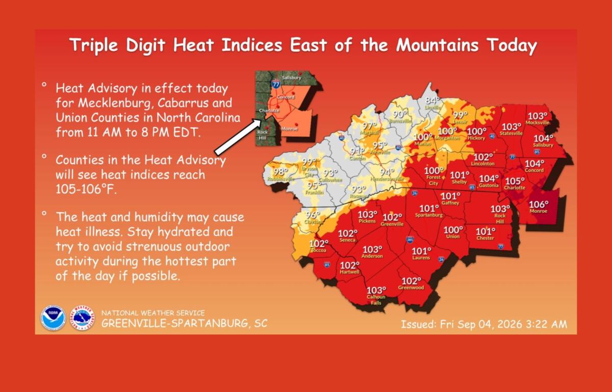
Saturday will be another hot one, with a high near 91 and a 30 percent chance of showers and thunderstorms after 3 p.m.
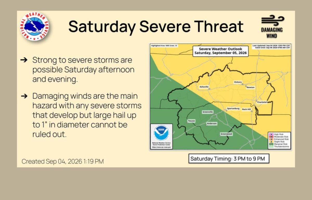
But the storms Saturday could pack a little more punch.
The National Weather Service office in Greenville-Spartanburg says a strong cold front will approach the area Saturday, bringing better coverage of showers and thunderstorms. Most areas along and east of Interstate 26 are under a Level 2 of 5, or slight, risk for severe weather.
The severe-weather threat is expected to peak from late Saturday afternoon into early Saturday evening, although storms could continue into the evening.
Damaging wind gusts are expected to be the main concern with any severe storms, with large hail also possible. Frequent lightning will also be a concern.
Chris Justus, chief meteorologist at WYFF 4, said the main window for strong storms appears to be from late afternoon into late evening.
Sunday will bring a different feel as the front moves through. The severe-weather threat is expected to be lower, but showers and thunderstorms will still be possible throughout the day.
Asheville has a 60 percent chance of precipitation Sunday, with a slight chance of showers before 11 a.m., followed by a chance of showers and thunderstorms through the afternoon. Showers and possibly a thunderstorm become more likely after 5 p.m.
The high will be around 88 degrees.
Sunday night will remain unsettled, with a 60 percent chance of showers and thunderstorms before 11 p.m., followed by a chance of showers into the early morning hours. The low will be around 64.
Then comes the cooldown.
Labor Day is expected to be partly sunny, with a high near 79 degrees. The overnight low will fall to about 62.
The National Weather Service says Monday should be the coolest day of the week as high pressure builds in behind the front. Temperatures will gradually climb again starting Tuesday, but the next stretch of warmer weather is expected to come with lower humidity.
So for weekend plans, Saturday is the day to keep the weather in mind, particularly from the afternoon into the evening. Sunday could still bring showers and thunderstorms, but the bigger change will be the cooler, less humid air arriving behind the front.
By Labor Day, it should feel much more like a break from summer.