


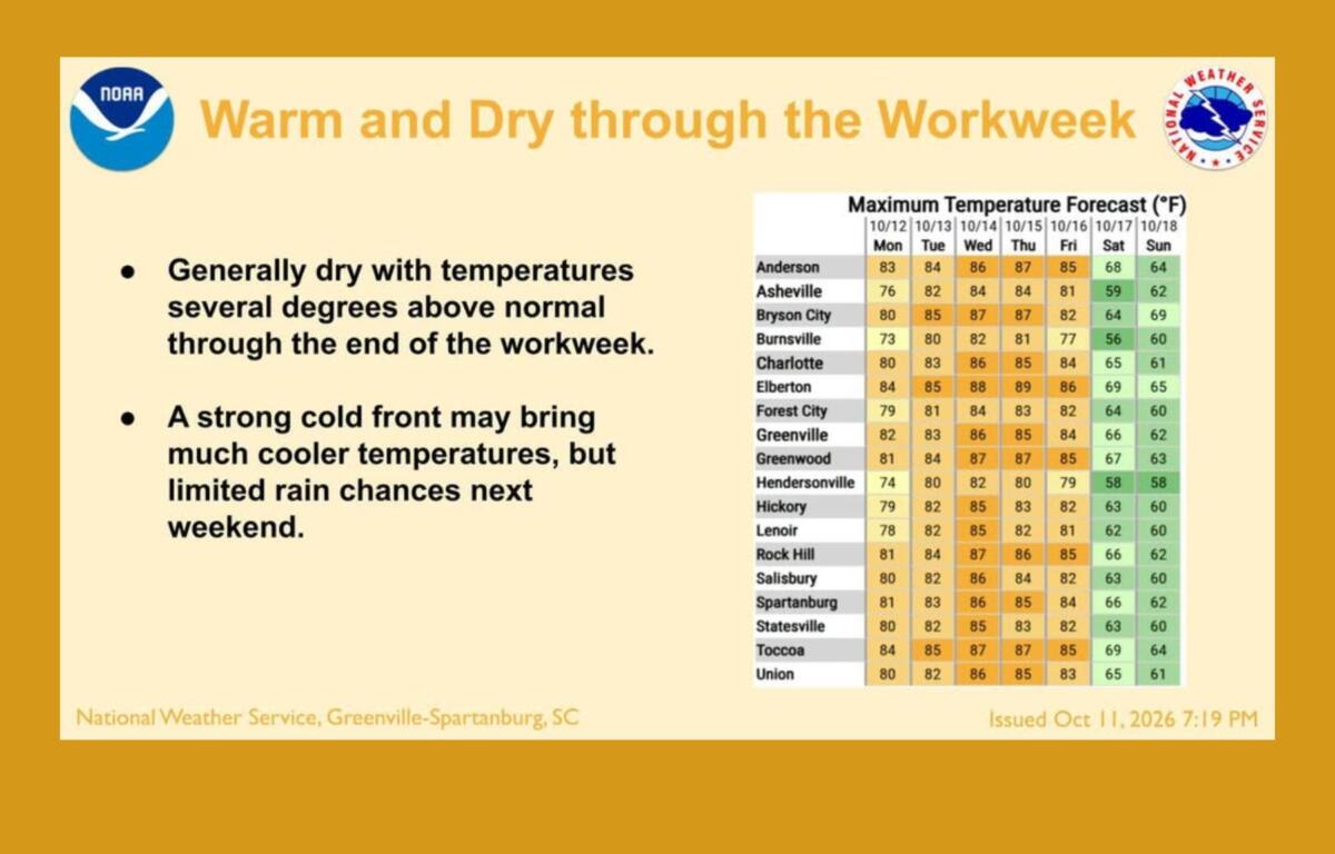

ASHEVILLE, N.C. (828newsNOW) — After a weekend of heavy rain and flooding, Western North Carolina can look forward to several days of sunshine and temperatures in the 80s. But the warm weather won’t last through the weekend.
The National Weather Service says skies will gradually clear Monday, Oct. 12, as the remnants of Isaias move away from the region. Asheville should reach a high near 76 degrees, about 5 degrees above normal for this time of year.
It will be a breezy Columbus Day, with northwest winds gusting as high as 31 mph in Asheville. Higher elevations could see gusts of 30 to 40 mph Monday morning before winds begin easing during the afternoon and evening.
Forecasters don’t expect the winds to be strong enough to require a wind advisory.
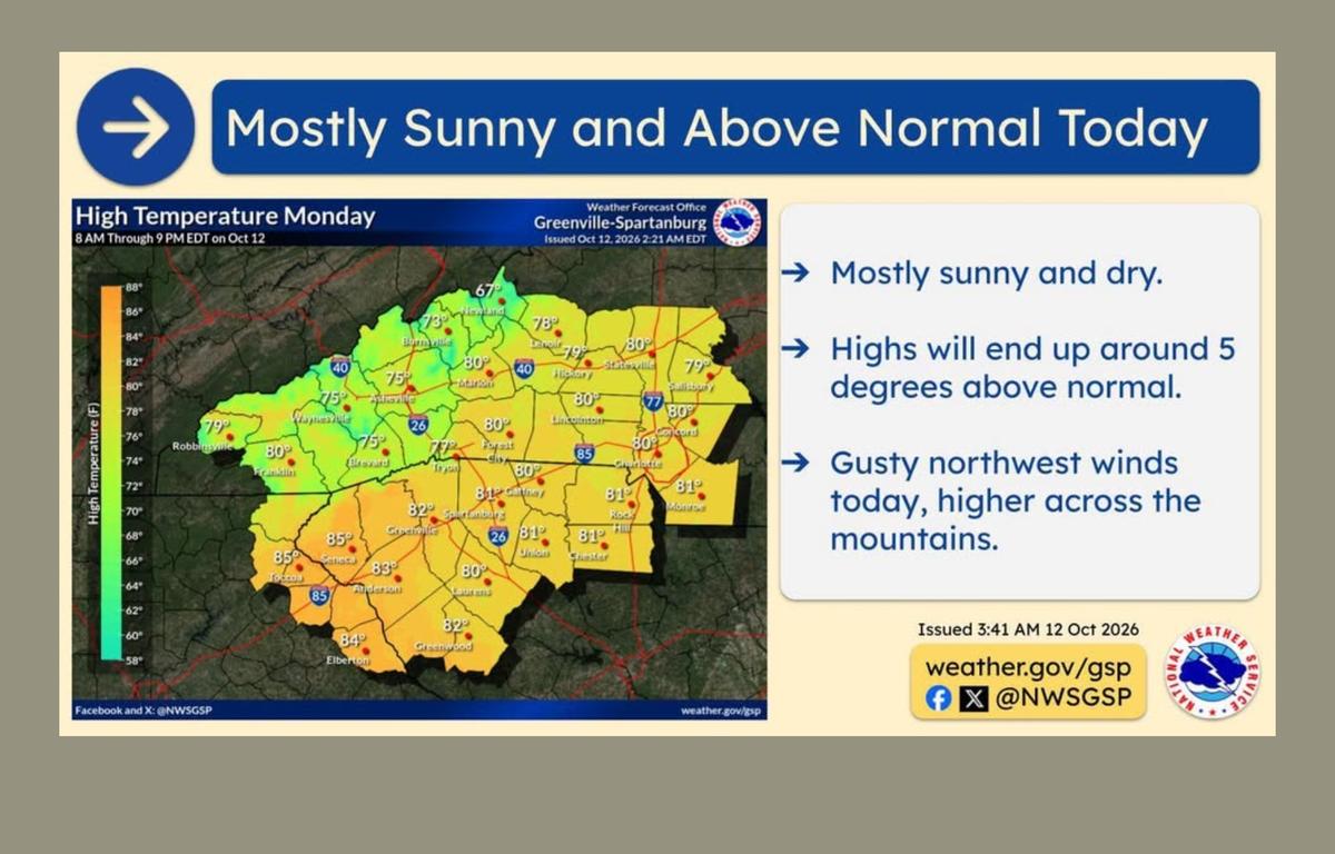
Sunshine and 80-degree temperatures return
The rest of the workweek is shaping up to be sunny, dry and unusually warm for mid-October.
After an overnight low around 50 degrees Monday, Asheville should warm into the low 80s Tuesday. Highs are expected to reach 85 degrees Wednesday and Thursday, with overnight temperatures generally staying in the 50s.
Friday should bring more sunshine and a high near 81.
The dry stretch will offer a break from the heavy rain that soaked Western North Carolina over the weekend. However, saturated ground and swollen waterways could take time to recover, particularly in areas that experienced flooding.
Cold front could bring frost, freezing temperatures
The warm spell is expected to end this weekend as a strong cold front moves through the region.
The National Weather Service says the front will bring much colder air, with temperatures falling 5 to 10 degrees below normal.
There isn’t much moisture associated with the front, so widespread rain isn’t expected. A few showers are possible as it crosses the mountains.
Gusty northwest winds will follow the front, along with what forecasters say could be the coldest temperatures of the season so far.
By Saturday night, lows could fall into the 30s across much of the mountains. Some areas, particularly at higher elevations and in colder valleys, could see frost or a light freeze.
It’s still too early to know exactly where freezing temperatures might develop.
Asheville’s forecast through Friday
- Monday: Clouds clearing by late morning, then mostly sunny. High near 76. Northwest wind gusts up to 31 mph. Low around 50 overnight.
- Tuesday: Sunny and warm, with a high near 82. Clear overnight, with a low around 53.
- Wednesday: Sunny, with a high near 85. Overnight low around 57.
- Thursday: Sunny, with a high near 85. Overnight low around 58.
- Friday: Mostly sunny, with a high near 81. Much colder weather is expected over the weekend.
Asheville rainfall already well above normal for October
The return of dry weather comes after a particularly wet start to October.
Asheville Regional Airport has recorded 5.25 inches of precipitation through Sunday, Oct. 11, according to National Weather Service climate data. That’s nearly 4 inches above the normal 1.29 inches for this point in the month.
Sunday brought another 0.60 inches of rain at the airport, compared with the daily normal of 0.10 inches.
Since Sept. 1, the airport has recorded 7.33 inches of precipitation, nearly 2 inches above normal.
For the year, precipitation totals stand at 40.20 inches, slightly above the normal 39.61 inches.
Although the coming days should give the region a chance to dry out, residents in flood-prone areas should remain aware of lingering high water and unstable ground following the weekend’s storms.