


ASHEVILLE, N.C. (828newsNOW) — Snow showers were showing up on radar across the mountains early Friday, with some of the highest peaks along the Tennessee border potentially picking up several inches before the weekend is over.
And while most of the accumulation is expected to stay in the higher elevations, some mountain valleys could see a few flakes, too.
The National Weather Service is forecasting 2 to 4 inches of snow in the Smokies, with isolated amounts up to 6 inches possible. Most other locations along the Tennessee border are expected to receive less than 2 inches.
But some weather models suggest the highest peaks could get even more.
Meteorologist Hunter Ward of Ashevillewx said the latest model guidance shows the potential for close to a foot of snow near Mount LeConte and Kuwohi, formerly known as Clingmans Dome, through Saturday.
Those locations are especially favorable for heavier snowfall because of the direction of the northwest winds.
The weather service said confidence in the higher snowfall amounts remains moderate, with most of the accumulation expected above 5,000 feet.
Snowflakes could also make an appearance in lower elevations.
Ward said valleys in Buncombe, Haywood, Graham, Jackson, Madison, Macon and Swain counties could see snow showers, particularly Friday evening into Saturday morning.
For Asheville and other lower-elevation communities, little or no accumulation is expected.
The possibility of winter weather has already prompted one mountain school system to cancel classes.
Madison County Schools announced that schools would be closed Friday, Nov. 13, because of the potential for winter weather in the county’s higher elevations. Friday will be an optional teacher workday.
The National Weather Service forecast issued early Friday called for a chance of rain and snow in Madison County, with up to an inch of accumulation possible Friday and additional snow possible Friday night.
Across the state line, a winter weather advisory is in effect for parts of the Tennessee mountains above 3,000 feet from 10 a.m. Friday until 1 p.m. Saturday. Forecasters expect up to 4 inches of snow, with locally higher amounts possible on the highest peaks.
The snow won’t be the only reminder that winter is on its way.
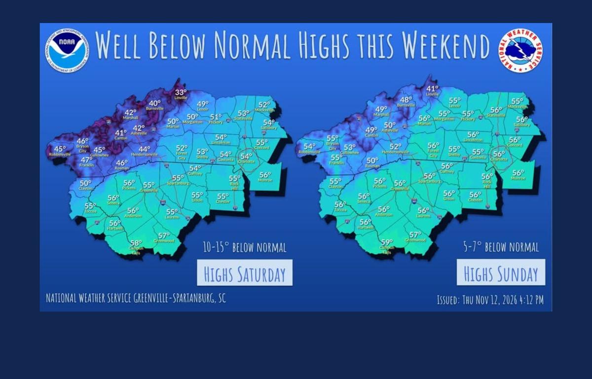
Winds could gust above 30 mph in parts of Western North Carolina, making already chilly temperatures feel even colder.
The National Weather Service expects snow showers to taper off by Saturday morning, although cold and gusty conditions will linger into the weekend.
Drivers heading into the higher elevations, especially along the Tennessee border, should be prepared for the possibility of slick roads and rapidly changing conditions.