



ASHEVILLE, N.C. (828newsNOW) — If you were hoping September would bring a quick taste of fall to the mountains, you may have to wait a little longer.
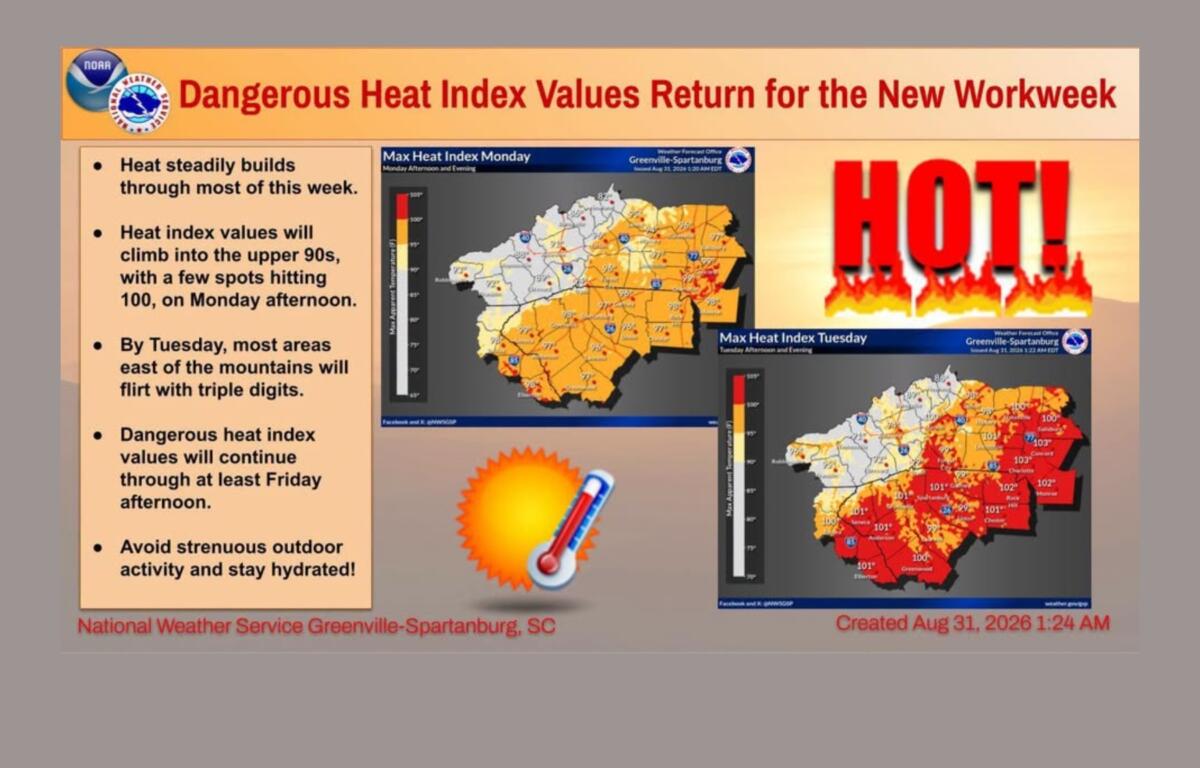
Heat and humidity are expected to return this week, with temperatures climbing into the low 90s in Asheville and heat index values reaching dangerous triple digits across much of the lower elevations outside the mountains.
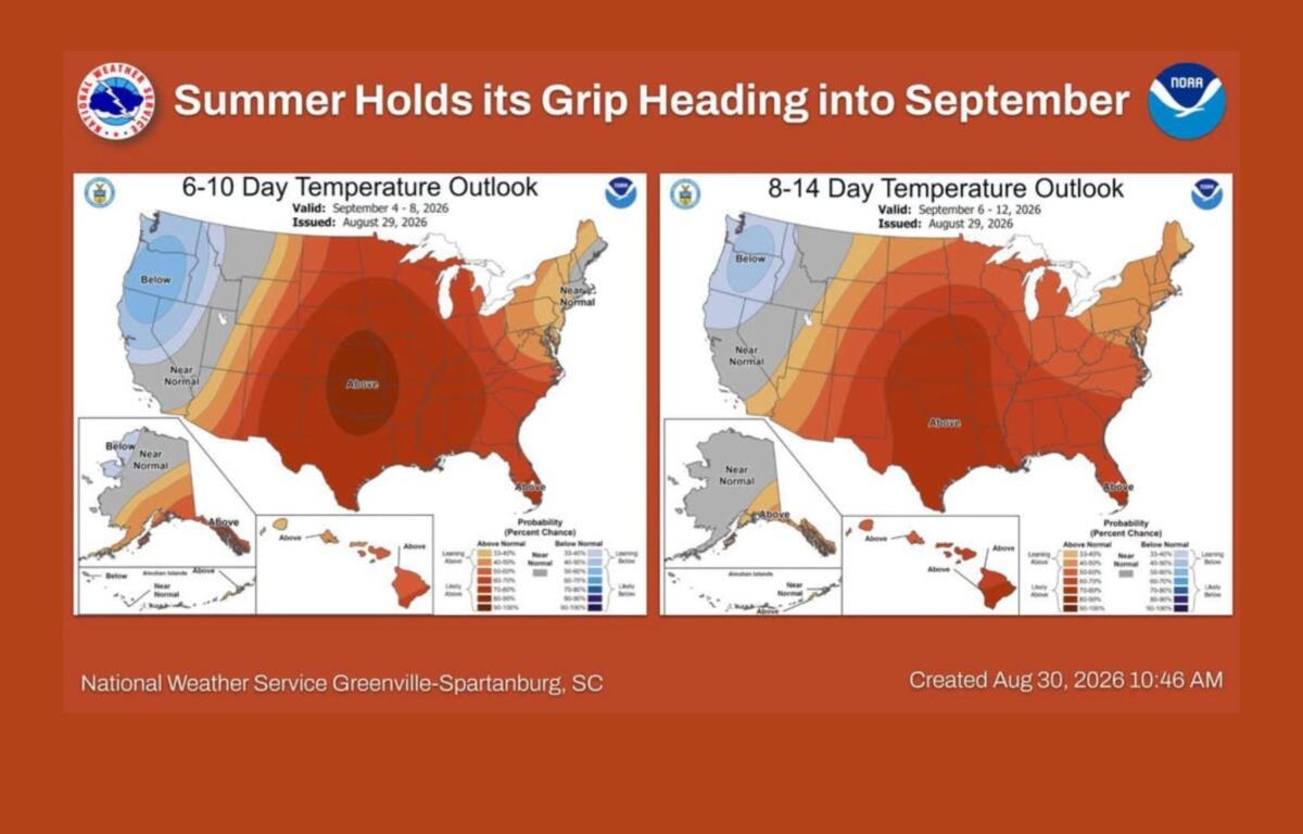
The National Weather Service Greenville-Spartanburg office said above-normal temperatures have a 50% to 70% chance of sticking around through at least the middle of September.
For Asheville, Monday will be relatively comfortable by comparison, with a high near 88 degrees under partly sunny skies. Patchy morning fog is possible before conditions turn mostly sunny.
Then the heat starts building.
Tuesday’s high is expected to reach about 91 degrees, followed by highs around 92 Wednesday and Thursday. Friday’s forecast calls for a high near 90.
While Asheville’s actual temperature is forecast to remain in the low 90s, the combination of heat and humidity could push heat index values into the 100s in lower elevations outside the mountains.
The National Weather Service said heat index values could reach the low to mid-100s from Tuesday through Friday, increasing the risk of heat-related illnesses, including heat exhaustion and heat stroke.
For anyone spending time outdoors this week, forecasters recommend staying hydrated and limiting strenuous activity during the hottest part of the day.
There won’t be much rain to break up the heat, either.
The weather service expects only isolated showers or thunderstorms in the mountains through the first half of the week. Any storms that develop are expected to be weak, with virtually no severe weather threat.
Asheville has a 30% chance of afternoon showers and thunderstorms Thursday and a 40% chance Friday.
The next chance for more widespread showers and thunderstorms could arrive late Friday or Saturday as a weak cold front approaches the region. Forecasters say there is still considerable uncertainty about the timing and strength of the front, so it’s too early to say how much relief it will bring.
For now, it looks like summer heat will be sticking around a while longer.
Asheville forecast
- Monday: Patchy fog before 9 a.m., then partly sunny and gradually becoming sunny. High near 88. Calm wind.
- Monday night: Mostly clear, with patchy fog after 3 a.m. Low around 66.
- Tuesday: Sunny, with a high near 91. Calm wind.
- Tuesday night: Mostly clear, with a low near 67.
- Wednesday: Sunny, with a high near 92.
- Wednesday night: Partly cloudy, with a low near 68.
- Thursday: Mostly sunny, with a 30% chance of showers and thunderstorms after 3 p.m. High near 92.
- Thursday night: A 30% chance of showers and thunderstorms before 8 p.m. Low near 68.
- Friday: Mostly sunny, with a 40% chance of showers and thunderstorms after 2 p.m. High near 90.