


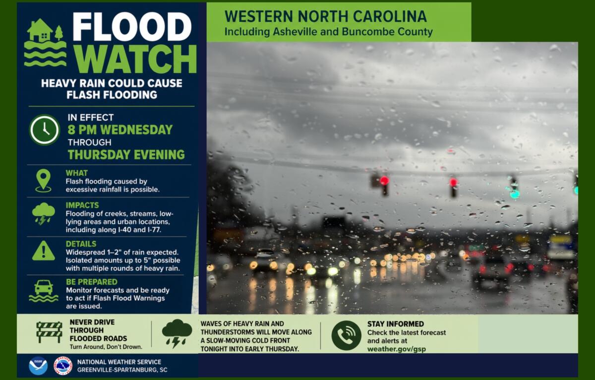

ASHEVILLE, N.C. (828newsNOW) — The National Weather Service has issued a Flood Watch for Asheville, Buncombe County and much of Western North Carolina beginning Wednesday night, warning that heavy rain could trigger flash flooding through Thursday evening.
The Flood Watch takes effect at 8 p.m. Wednesday and remains in effect until Thursday evening.
Forecasters say waves of heavy rain and scattered thunderstorms are expected to develop along a slow-moving cold front, bringing widespread rainfall totals of 1 to 2 inches across the mountains. However, repeated rounds of heavy rain could produce localized rainfall totals of up to 5 inches in some areas.
The watch includes Buncombe, Haywood, Henderson, Madison, Transylvania, Yancey, Mitchell, Swain, Graham, Macon and Jackson counties, among others in Western North Carolina.
The National Weather Service said excessive rainfall could lead to flash flooding, particularly in low-lying and flood-prone areas. Creeks and streams could rise quickly, and flooding is also possible in urban areas and along major transportation corridors.
The greatest concern is that multiple rounds of heavy rain could move over the same locations, increasing the risk of dangerous runoff and rapidly rising water.
Residents are urged to closely monitor weather forecasts and be prepared to act quickly if Flash Flood Warnings are issued. Unlike a Flood Watch, which means conditions are favorable for flooding, a Flash Flood Warning indicates flooding is occurring or imminent.
Motorists should never drive through flooded roadways. Just a small amount of moving water can sweep away a vehicle, and the depth of floodwater is often difficult to judge, especially at night.
The latest forecasts and flood safety information are available from the National Weather Service.