


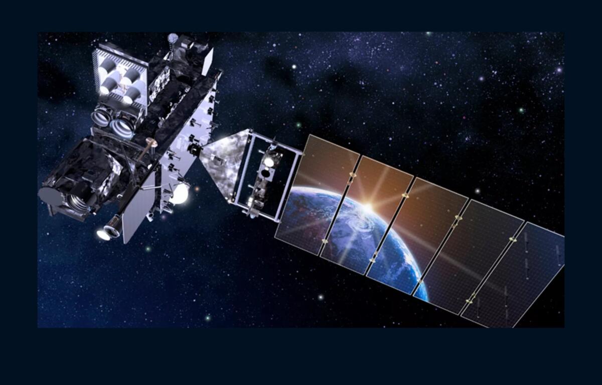

ASHEVILLE, N.C. (828newsNOW) — Forecasters across Western North Carolina are watching the potential for another round of afternoon thunderstorms while also tracking a tropical system in the Gulf of Mexico following last week’s outage of a key weather satellite.
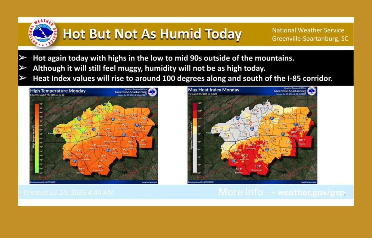
The National Weather Service Greenville-Spartanburg office said Monday that temperatures will climb into the low to mid-90s outside the mountains, with heat index values near 100 degrees along and south of the Interstate 85 corridor. Scattered thunderstorms are expected again during the afternoon and early evening.
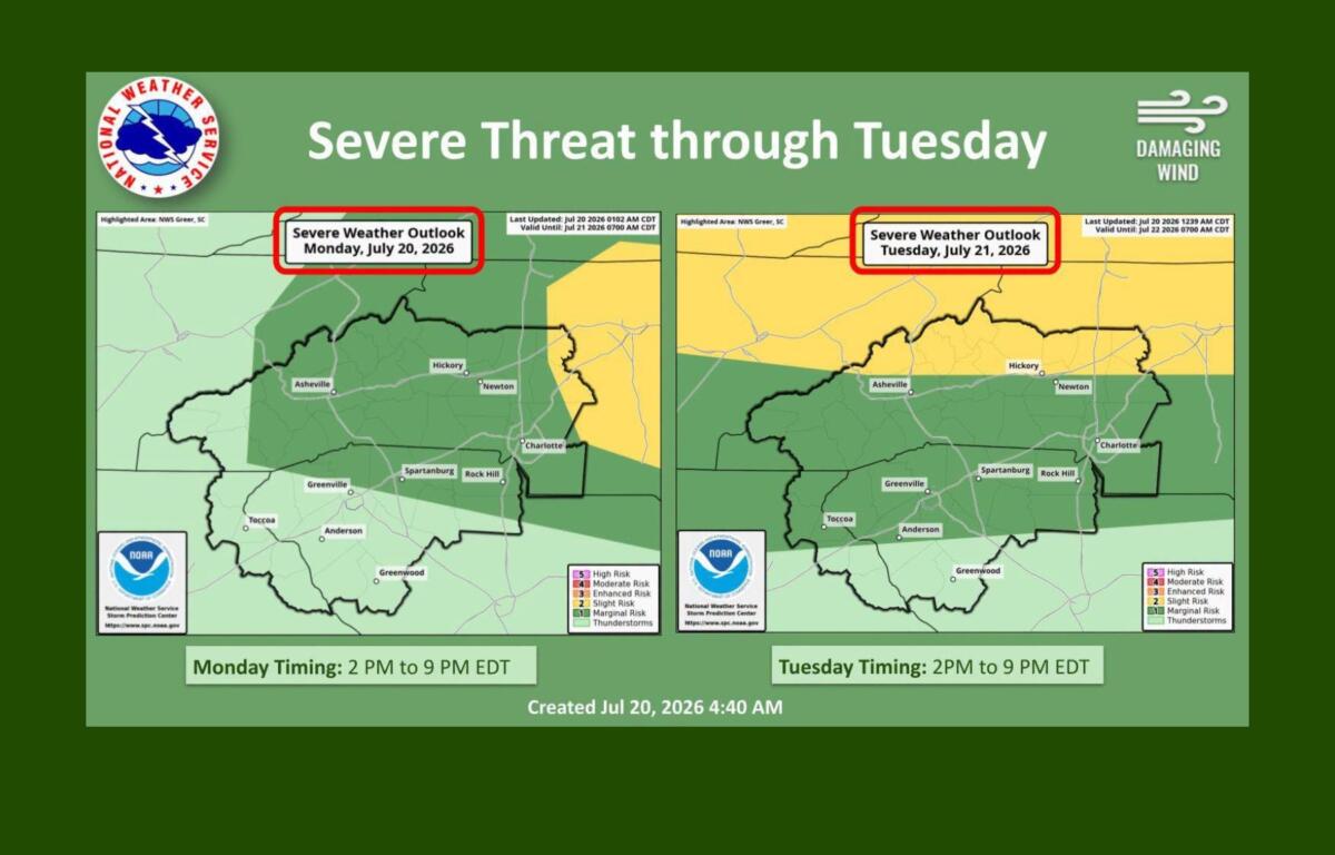
A few storms could become severe, with damaging wind gusts as the primary concern.
While the mountains, including the Asheville area, are not expected to see a direct impact from Tropical Depression Two in the Gulf of Mexico, the system could increase tropical moisture across the region later this week and bring higher rain chances.
NOAA said imagery from GOES-East, the satellite operated as GOES-19, is being used by forecasters to monitor Tropical Depression Two as it moves through the northeastern Gulf of Mexico. The system was expected to strengthen into a tropical storm, and a Tropical Storm Watch was issued for parts of the Florida Panhandle and coastal Alabama.
The tropical system comes after GOES-19 experienced an anomaly last week that temporarily disrupted a major source of weather data used by meteorologists across the eastern United States.
What the GOES-19 outage meant for Western North Carolina
GOES-19 entered a protective “Safehold Mode” on July 15 after experiencing an anomaly, according to NOAA. The protective mode is designed to safeguard the spacecraft while engineers investigate and work to restore operations.
The satellite stopped transmitting weather data while in Safehold Mode, temporarily preventing the delivery of new GOES-East visible, infrared and water vapor imagery.
Those images provide critical real-time information used by forecasters to track thunderstorms, cloud development, tropical systems, wildfire smoke and other rapidly changing weather conditions.
For the National Weather Service Greenville-Spartanburg office, the outage meant losing access to continuously updated GOES-East imagery while the satellite was offline.
However, the outage, which lasted about 20 hours, did not stop meteorologists from issuing forecasts, watches or warnings.
Forecasters continued using Doppler radar, including the Greer radar, along with surface weather stations, weather balloon observations, lightning detection networks, aircraft reports and computer weather models.
For most residents, the most noticeable impact was on weather websites and apps, where satellite loops may have appeared frozen or unavailable.
828newsNOW has reached out to NOAA and the National Weather Service for additional information about the outage, including what caused the anomaly and whether the length of the disruption was unusual.
Why GOES-19 matters
GOES stands for Geostationary Operational Environmental Satellite. The spacecraft orbits about 22,000 miles above Earth and remains positioned over the same region, allowing meteorologists to continuously monitor weather systems as they develop.
GOES-19 is part of NOAA’s latest generation of weather satellites and became the operational GOES-East satellite in 2025, replacing GOES-16.
The satellite carries the Advanced Baseline Imager, which provides high-resolution visible and infrared imagery, as well as the Geostationary Lightning Mapper, which detects lightning activity across large portions of the Western Hemisphere.
Those tools are especially valuable during severe weather outbreaks and hurricane season, when forecasters need frequent updates on developing storms.
Short interruptions can occur during satellite maintenance or calibration, but a satellite entering Safehold Mode and stopping data transmission is less common.
NOAA later reported that engineers recovered GOES-19 from Safehold Mode and began restarting its instruments. The agency has not publicly detailed the cause of the anomaly.
NOAA maintains backup capabilities, including other satellites that can provide limited coverage if needed. However, GOES-East is specifically positioned to provide continuous coverage of the eastern United States, Atlantic Ocean, Caribbean and Gulf of Mexico.
For Western North Carolina, where communities continue recovering from the devastating flooding caused by Tropical Storm Helene in 2024, reliable weather monitoring remains especially important as the region enters another active summer storm season.
Forecasters will continue monitoring local storms, tropical moisture and changing conditions throughout the week.