


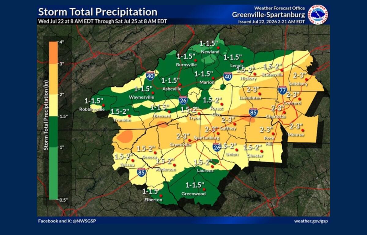

ASHEVILLE, N.C. (828newsNOW) — Several rounds of thunderstorms are expected across Asheville and Western North Carolina through the end of the week, bringing the potential for heavy rainfall, isolated flooding and a few severe storms.
The National Weather Service in Greenville-Spartanburg said a slow-moving frontal boundary settling over the region will create an active weather pattern through at least Friday, with the greatest concerns being heavy downpours and localized flash flooding.
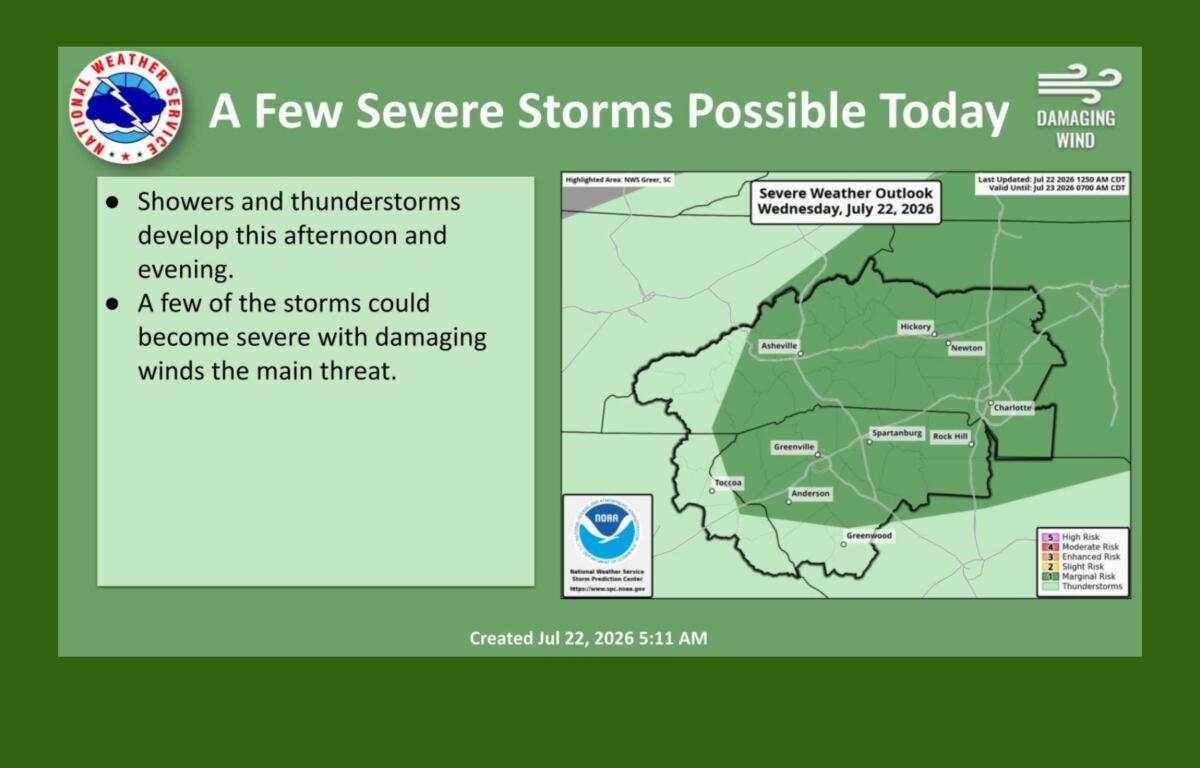
Forecasters said some storms this afternoon and evening could become severe, with damaging wind gusts the primary threat.
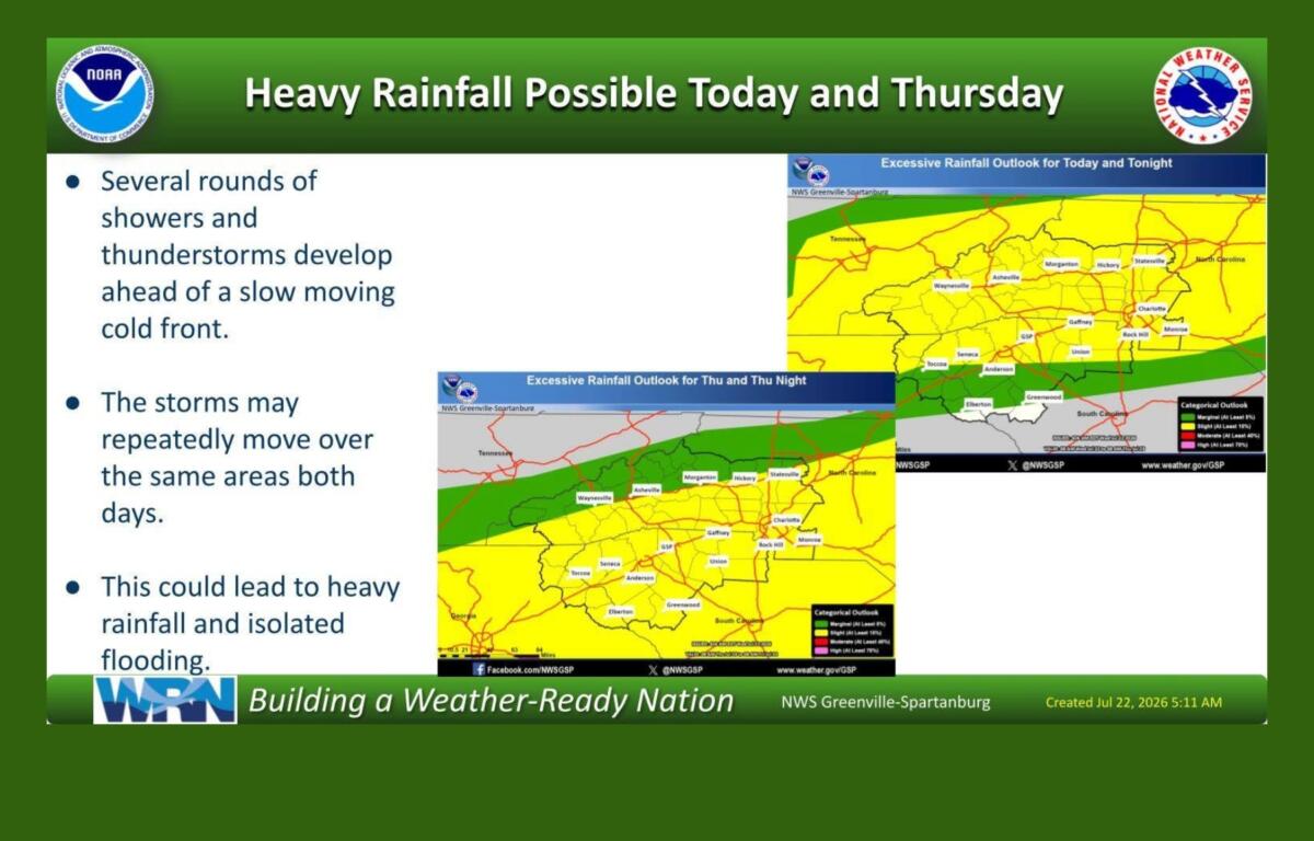
Buncombe County Emergency Management said there is currently no flood watch in effect and widespread severe flooding is not expected. Officials said streams and reservoirs have available capacity, but isolated flooding could still occur in areas that receive repeated heavy rainfall.
“Even when it’s isolated, it’s never safe to drive or walk in flood waters,” Buncombe County officials said in a social media post.
Officials reminded residents that just 12 inches of rushing water can carry away most cars, while 2 feet of rushing water can move SUVs and trucks.
The National Weather Service said the heaviest rainfall threat comes as storms move along the stalled boundary through Friday. Forecasters said the atmosphere will contain high moisture levels, which could allow some storms to produce efficient, heavy rainfall over short periods.
Because storms may repeatedly track over the same areas, some locations could see higher rainfall totals than others, creating the potential for localized flash flooding.
Forecast uncertainty remains regarding exactly where the heaviest rainfall will occur, which is why forecasters have not issued a flood watch for the region.
The active weather pattern is expected to ease heading into the weekend, with drier conditions returning by Sunday. Temperatures are expected to return closer to typical late July levels early next week.
Buncombe County residents can sign up for emergency alerts by texting BCReady to 67283.
Residents should also avoid driving through flooded roadways and monitor forecasts as storms move through the region.