


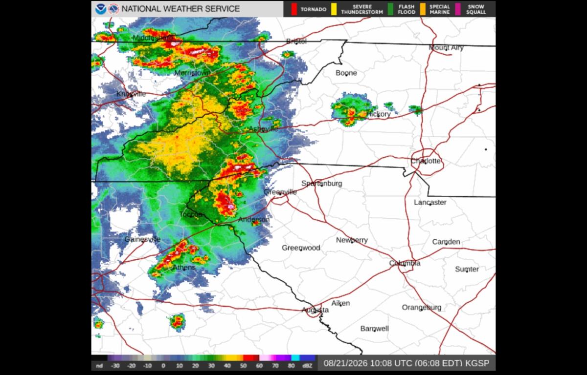

ASHEVILLE, N.C. (828newsNOW) — Storms were moving into the Asheville area Friday morning, with more widespread thunderstorms expected this afternoon and into the evening.
The storms could bring damaging wind gusts, heavy rain and isolated flash flooding across Western North Carolina, according to the National Weather Service Greenville-Spartanburg office.
Some areas could see rainfall totals of more than 3 inches, with the greatest concern in places that received heavy rain Thursday. Forecasters said the exact location of the heaviest rain remains uncertain, but conditions will be closely monitored for a possible flood watch later Friday.
A line of strong thunderstorms was moving northeast through parts of northeast Georgia and the western Carolinas early Friday. The storms were producing wind gusts of up to 50 mph and half-inch hail, according to the weather service.
For the Asheville area, the weather service expects scattered showers and thunderstorms to become more widespread this afternoon as a cold front moves into the region.
Some storms could become severe, producing damaging wind gusts. Heavy downpours also could cause localized flooding, particularly in areas where the ground is already saturated.
“Repeated downpours and strong storms could produce locally significant rainfall and flooding,” WYFF 4 Chief Meteorologist Chris Justus said Friday morning.
What Asheville-area residents should know
Forecasters expect the greatest storm activity from the afternoon into the evening.
The National Weather Service said storms could organize along outflows and produce damaging wind gusts. The overall severe weather threat is considered marginal for most of the region, with a slightly higher risk around the Charlotte area.
The Asheville area also could see periods of reduced visibility and changing winds during thunderstorms. At Asheville Regional Airport, forecasters expect showers and possibly thunderstorms to develop later Friday.
Residents should be prepared for rapidly changing conditions, especially if thunderstorms move overhead. Those outdoors should move inside a sturdy building when storms approach.
The weather pattern should improve heading into the weekend.
Saturday could still bring a few afternoon showers and thunderstorms, but drier and more stable air is expected to move into Western North Carolina by Sunday.
The drier weather is expected to continue through at least the first half of next week, with afternoon shower and thunderstorm chances returning around the middle of next week.
Weather safety: Never drive through a flooded roadway. Even shallow moving water can make roads dangerous, and water levels can rise quickly during heavy downpours.